Saint-Maxent | |
|---|---|
 The town hall in Saint-Maxent | |
 Saint-Maxent  Saint-Maxent | |
| Coordinates: 50°00′25″N 1°43′49″E / 50.0069°N 1.7303°E | |
| Country | France |
| Region | Hauts-de-France |
| Department | Somme |
| Arrondissement | Abbeville |
| Canton | Gamaches |
| Intercommunality | CC Aumale - Blangy-sur-Bresle |
| Government | |
| • Mayor (2020–2026) | Bernard Leneveu [1] |
| Area 1 | 6.38 km2 (2.46 sq mi) |
| Population (2021)
[2] | 393 |
| • Density | 62/km2 (160/sq mi) |
| Time zone | UTC+01:00 ( CET) |
| • Summer ( DST) | UTC+02:00 ( CEST) |
| INSEE/Postal code |
80710 /80140 |
| Elevation | 93–118 m (305–387 ft) (avg. 114 m or 374 ft) |
| 1 French Land Register data, which excludes lakes, ponds, glaciers > 1 km2 (0.386 sq mi or 247 acres) and river estuaries. | |
Saint-Maxent (French pronunciation: [sɛ̃ maksɑ̃]; Picard: Saint-Manchin) is a commune in the Somme department in Hauts-de-France in northern France.
Geography
The commune is situated some 10 miles (16 km) southwest of Abbeville, on the D86 and D29 road junction, about a mile from the A28 autoroute.
Population
| Year | Pop. | ±% p.a. |
|---|---|---|
| 1968 | 417 | — |
| 1975 | 379 | −1.36% |
| 1982 | 365 | −0.54% |
| 1990 | 365 | +0.00% |
| 1999 | 369 | +0.12% |
| 2007 | 389 | +0.66% |
| 2012 | 404 | +0.76% |
| 2017 | 392 | −0.60% |
| 2019 | 395 | +0.38% |
| Source: INSEE [3] [4] | ||
Places of interest
- The church
- The old railway line [5]
The railway was opened on 9 May 1872 and was used principally from freight, although some passengers were carried.
It was finally closed on 10 November 1993. It served the following communes:
Longpré-les-Corps-Saints /
Bettencourt-Rivière /
Airaines /
Allery /
Wiry-au-Mont /
Forceville /
Oisemont /
Cerisy-Buleux /
Martainneville / Saint-Maxent / Vismes-au-Val /
Maisnières /
Longroy and
Gamaches

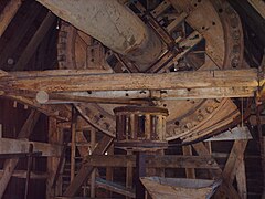
- The mill of Saint-Maxent, 2006
-

-


See also
References
- ^ "Répertoire national des élus: les maires" (in French). data.gouv.fr, Plateforme ouverte des données publiques françaises. 13 September 2022.
- ^ "Populations légales 2021". The National Institute of Statistics and Economic Studies. 28 December 2023.
- ^ Population en historique depuis 1968, INSEE
- ^ Populations légales 2019: 80 Somme, INSEE
- ^ Source:Fcvnet Archived 10 February 2012 at the Wayback Machine
| Authority control databases: National |
|---|
Saint-Maxent | |
|---|---|
|
The town hall in Saint-Maxent | |
Saint-Maxent Saint-Maxent | |
| Coordinates: 50°00′25″N 1°43′49″E / 50.0069°N 1.7303°E | |
| Country | France |
| Region | Hauts-de-France |
| Department | Somme |
| Arrondissement | Abbeville |
| Canton | Gamaches |
| Intercommunality | CC Aumale - Blangy-sur-Bresle |
| Government | |
| • Mayor (2020–2026) | Bernard Leneveu [1] |
| Area 1 | 6.38 km2 (2.46 sq mi) |
| Population (2021)
[2] | 393 |
| • Density | 62/km2 (160/sq mi) |
| Time zone | UTC+01:00 ( CET) |
| • Summer ( DST) | UTC+02:00 ( CEST) |
| INSEE/Postal code |
80710 /80140 |
| Elevation | 93–118 m (305–387 ft) (avg. 114 m or 374 ft) |
| 1 French Land Register data, which excludes lakes, ponds, glaciers > 1 km2 (0.386 sq mi or 247 acres) and river estuaries. | |
Saint-Maxent (French pronunciation: [sɛ̃ maksɑ̃]; Picard: Saint-Manchin) is a commune in the Somme department in Hauts-de-France in northern France.
Geography
The commune is situated some 10 miles (16 km) southwest of Abbeville, on the D86 and D29 road junction, about a mile from the A28 autoroute.
Population
| Year | Pop. | ±% p.a. |
|---|---|---|
| 1968 | 417 | — |
| 1975 | 379 | −1.36% |
| 1982 | 365 | −0.54% |
| 1990 | 365 | +0.00% |
| 1999 | 369 | +0.12% |
| 2007 | 389 | +0.66% |
| 2012 | 404 | +0.76% |
| 2017 | 392 | −0.60% |
| 2019 | 395 | +0.38% |
| Source: INSEE [3] [4] | ||
Places of interest
- The church
- The old railway line [5]
The railway was opened on 9 May 1872 and was used principally from freight, although some passengers were carried.
It was finally closed on 10 November 1993. It served the following communes:
Longpré-les-Corps-Saints /
Bettencourt-Rivière /
Airaines /
Allery /
Wiry-au-Mont /
Forceville /
Oisemont /
Cerisy-Buleux /
Martainneville / Saint-Maxent / Vismes-au-Val /
Maisnières /
Longroy and
Gamaches
- The mill of Saint-Maxent, 2006
-
-
See also
References
- ^ "Répertoire national des élus: les maires" (in French). data.gouv.fr, Plateforme ouverte des données publiques françaises. 13 September 2022.
- ^ "Populations légales 2021". The National Institute of Statistics and Economic Studies. 28 December 2023.
- ^ Population en historique depuis 1968, INSEE
- ^ Populations légales 2019: 80 Somme, INSEE
- ^ Source:Fcvnet Archived 10 February 2012 at the Wayback Machine
| Authority control databases: National |
|---|