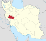
Derakht Chaman
Persian: درخت چمن | |
|---|---|
Former Village | |
| Coordinates: 33°12′29″N 49°10′34″E / 33.20806°N 49.17611°E [1] | |
| Country | Iran |
| Province | Lorestan |
| County | Aligudarz |
| District | Zaz va Mahru |
| Rural District | Zaz-e Sharqi |
| Population (2006)
[2] | |
| • Total | 146 |
| Time zone | UTC+3:30 ( IRST) |
Derakht Chaman ( Persian: درخت چمن) [3] was a village in Zaz-e Sharqi Rural District of Zaz va Mahru District, Aligudarz County, Lorestan province, Iran.
At the 2006 National Census, its population was 146 in 28 households. [2]
After the census, the village of Shulabad-e Sofla merged with the villages of Asar, Del Suran, Derakht Chaman, Khodadadkosh-e Olya, Khodadadkosh-e Sofla, Sarlak, and Shulabad-e Olya, with its name changed to Shulabad upon its elevation to the status of a city. [4]
References
- ^ OpenStreetMap contributors (22 August 2023). "Derakht Chaman, Aligudarz County" (Map). OpenStreetMap. Retrieved 22 August 2023.
- ^ a b "Census of the Islamic Republic of Iran, 1385 (2006)". AMAR (in Persian). The Statistical Center of Iran. p. 15. Archived from the original (Excel) on 20 September 2011. Retrieved 25 September 2022.
- ^ Derakht Chaman can be found at GEOnet Names Server, at this link, by opening the Advanced Search box, entering "-3784326" in the "Unique Feature Id" form, and clicking on "Search Database".
- ^ Rahimi, Mohammadreza (21 July 2019). "Letter of approval regarding the conversion of Shulabad village, the center of Zaz va Mahru District, from the functions of Aligudarz County in Lorestan province, to a city". Vekalat Online (in Persian). Ministry of Interior, Political and Defense Commission. Archived from the original on 21 August 2023. Retrieved 21 August 2023.

