Photos • Location


Size of this preview:
800 × 531 pixels. Other resolutions:
320 × 213 pixels |
640 × 425 pixels |
1,024 × 680 pixels |
1,280 × 850 pixels |
2,560 × 1,700 pixels |
3,400 × 2,258 pixels.
Original file (3,400 × 2,258 pixels, file size: 5.1 MB, MIME type: image/jpeg)
| This is a file from the
Wikimedia Commons. Information from its
description page there is shown below. Commons is a freely licensed media file repository. You can help. |
Summary
| Description |
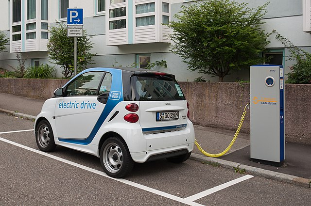
Deutsch: EnBW-Ladestation in Stuttgart mit einem Car2Go-Elektro-Smart der dritten Generation.
English: EnBW electric car charging station in Stuttgart with a 3rd generation Smart electric car of carsharing company Car2Go |
|
| Date | Taken on 23 August 2013, 09:30:42 | |
| Source | Own work | |
| Author |
Julian Herzog (
Website) | |
| Equipment | Nikon D5000 with AF-S DX NIKKOR 18-105 mm f/3.5-5.6G ED VR. | |
| Parameters | Focal length 25 mm equivalent to 37 mm in a 35 mm format system Angle of view (before crop) 61° Exposure time 1/80 s Relative aperture f/13 ISO 200 Exposure program Aperture priority |
|
| Other versions |
|


| Object location |
| View this and other nearby images on: OpenStreetMap |
|
|---|
Licensing
Julian Herzog, the copyright holder of this work, hereby publishes it under the following licenses:

|
Permission is granted to copy, distribute and/or modify this document under the terms of the GNU Free Documentation License, Version 1.2 or any later version published by the Free Software Foundation; with no Invariant Sections, no Front-Cover Texts, and no Back-Cover Texts. A copy of the license is included in the section entitled GNU Free Documentation License. |
This file is licensed under the
Creative Commons
Attribution 4.0 International license.
Attribution:
Julian Herzog
- You are free:
- to share – to copy, distribute and transmit the work
- to remix – to adapt the work
- Under the following conditions:
- attribution – You must give appropriate credit, provide a link to the license, and indicate if changes were made. You may do so in any reasonable manner, but not in any way that suggests the licensor endorses you or your use.
You may select the license of your choice.
This image has been assessed using the
Quality image guidelines and is considered a
Quality image.
|
File history
Click on a date/time to view the file as it appeared at that time.
| Date/Time | Thumbnail | Dimensions | User | Comment | |
|---|---|---|---|---|---|
| current | 19:55, 23 August 2013 |
| 3,400 × 2,258 (5.1 MB) | Julian Herzog |
File usage
More than 100 pages use this file. The following list shows the first 100 pages that use this file only. A full list is available.
- Battery electric vehicle
- CHAdeMO
- ChaoJi
- Charging station
- Combined Charging System
- Electric bicycle
- Electric boat
- Electric car
- Electric car use by country
- Electric motorcycles and scooters
- Electric truck
- Electric vehicle
- Electric vehicle charging network
- Fuel cell vehicle
- GB/T charging standard
- Government incentives for plug-in electric vehicles
- Hozon Auto
- Hybrid electric vehicle
- Hybrid electric vehicles in the United States
- IEC 61851
- IEC 62196
- IEC 63110
- ISO 15118
- Megawatt Charging System
- Plug-in electric vehicle
- Plug-in electric vehicles in Alabama
- Plug-in electric vehicles in Alaska
- Plug-in electric vehicles in Alberta
- Plug-in electric vehicles in Arizona
- Plug-in electric vehicles in Australia
- Plug-in electric vehicles in British Columbia
- Plug-in electric vehicles in California
- Plug-in electric vehicles in Canada
- Plug-in electric vehicles in China
- Plug-in electric vehicles in Colorado
- Plug-in electric vehicles in Connecticut
- Plug-in electric vehicles in Delaware
- Plug-in electric vehicles in Europe
- Plug-in electric vehicles in Florida
- Plug-in electric vehicles in France
- Plug-in electric vehicles in Georgia (U.S. state)
- Plug-in electric vehicles in Germany
- Plug-in electric vehicles in Hawaii
- Plug-in electric vehicles in Hong Kong
- Plug-in electric vehicles in Iceland
- Plug-in electric vehicles in Idaho
- Plug-in electric vehicles in Illinois
- Plug-in electric vehicles in India
- Plug-in electric vehicles in Indiana
- Plug-in electric vehicles in Japan
- Plug-in electric vehicles in Louisiana
- Plug-in electric vehicles in Maine
- Plug-in electric vehicles in Maryland
- Plug-in electric vehicles in Massachusetts
- Plug-in electric vehicles in Michigan
- Plug-in electric vehicles in Minnesota
- Plug-in electric vehicles in Nevada
- Plug-in electric vehicles in New Brunswick
- Plug-in electric vehicles in New Hampshire
- Plug-in electric vehicles in New Jersey
- Plug-in electric vehicles in New Mexico
- Plug-in electric vehicles in New York (state)
- Plug-in electric vehicles in New Zealand
- Plug-in electric vehicles in Newfoundland and Labrador
- Plug-in electric vehicles in North Carolina
- Plug-in electric vehicles in Norway
- Plug-in electric vehicles in Nova Scotia
- Plug-in electric vehicles in Ohio
- Plug-in electric vehicles in Ontario
- Plug-in electric vehicles in Oregon
- Plug-in electric vehicles in Pakistan
- Plug-in electric vehicles in Pennsylvania
- Plug-in electric vehicles in Prince Edward Island
- Plug-in electric vehicles in Quebec
- Plug-in electric vehicles in Rhode Island
- Plug-in electric vehicles in Saskatchewan
- Plug-in electric vehicles in Sweden
- Plug-in electric vehicles in Tennessee
- Plug-in electric vehicles in Texas
- Plug-in electric vehicles in Utah
- Plug-in electric vehicles in Vermont
- Plug-in electric vehicles in Virginia
- Plug-in electric vehicles in Washington, D.C.
- Plug-in electric vehicles in Washington (state)
- Plug-in electric vehicles in Wisconsin
- Plug-in electric vehicles in the Netherlands
- Plug-in electric vehicles in the United Kingdom
- Plug-in electric vehicles in the United States
- Plug-in hybrid
- SAE J1772
- SAE J3068
- SAE J3105
- Smart electric drive
- Tesla Semi
- Tesla Supercharger
- Type 2 connector
- Type 3 connector
- Vehicle-to-grid
- VinFast
- VinFast VF 8
View more links to this file.
Global file usage
The following other wikis use this file:
- Usage on de.wikipedia.org
- Usage on fa.wikipedia.org
- Usage on pl.wikipedia.org
- Usage on pt.wikipedia.org
- Usage on si.wikipedia.org
- Usage on www.wikidata.org
- Usage on zh.wikipedia.org
- Usage on zh.wiktionary.org
Metadata
Size of this preview:
800 × 531 pixels. Other resolutions:
320 × 213 pixels |
640 × 425 pixels |
1,024 × 680 pixels |
1,280 × 850 pixels |
2,560 × 1,700 pixels |
3,400 × 2,258 pixels.
Original file (3,400 × 2,258 pixels, file size: 5.1 MB, MIME type: image/jpeg)
| This is a file from the
Wikimedia Commons. Information from its
description page there is shown below. Commons is a freely licensed media file repository. You can help. |
Summary
| Description |
Deutsch: EnBW-Ladestation in Stuttgart mit einem Car2Go-Elektro-Smart der dritten Generation.
English: EnBW electric car charging station in Stuttgart with a 3rd generation Smart electric car of carsharing company Car2Go |
|
| Date | Taken on 23 August 2013, 09:30:42 | |
| Source | Own work | |
| Author |
Julian Herzog (
Website) | |
| Equipment | Nikon D5000 with AF-S DX NIKKOR 18-105 mm f/3.5-5.6G ED VR. | |
| Parameters | Focal length 25 mm equivalent to 37 mm in a 35 mm format system Angle of view (before crop) 61° Exposure time 1/80 s Relative aperture f/13 ISO 200 Exposure program Aperture priority |
|
| Other versions |
|
| Object location |
| View this and other nearby images on: OpenStreetMap |
|
|---|
Licensing
Julian Herzog, the copyright holder of this work, hereby publishes it under the following licenses:
|
|
Permission is granted to copy, distribute and/or modify this document under the terms of the GNU Free Documentation License, Version 1.2 or any later version published by the Free Software Foundation; with no Invariant Sections, no Front-Cover Texts, and no Back-Cover Texts. A copy of the license is included in the section entitled GNU Free Documentation License. |
This file is licensed under the
Creative Commons
Attribution 4.0 International license.
Attribution:
Julian Herzog
- You are free:
- to share – to copy, distribute and transmit the work
- to remix – to adapt the work
- Under the following conditions:
- attribution – You must give appropriate credit, provide a link to the license, and indicate if changes were made. You may do so in any reasonable manner, but not in any way that suggests the licensor endorses you or your use.
You may select the license of your choice.
This image has been assessed using the
Quality image guidelines and is considered a
Quality image.
|
File history
Click on a date/time to view the file as it appeared at that time.
| Date/Time | Thumbnail | Dimensions | User | Comment | |
|---|---|---|---|---|---|
| current | 19:55, 23 August 2013 |
| 3,400 × 2,258 (5.1 MB) | Julian Herzog |
File usage
More than 100 pages use this file. The following list shows the first 100 pages that use this file only. A full list is available.
- Battery electric vehicle
- CHAdeMO
- ChaoJi
- Charging station
- Combined Charging System
- Electric bicycle
- Electric boat
- Electric car
- Electric car use by country
- Electric motorcycles and scooters
- Electric truck
- Electric vehicle
- Electric vehicle charging network
- Fuel cell vehicle
- GB/T charging standard
- Government incentives for plug-in electric vehicles
- Hozon Auto
- Hybrid electric vehicle
- Hybrid electric vehicles in the United States
- IEC 61851
- IEC 62196
- IEC 63110
- ISO 15118
- Megawatt Charging System
- Plug-in electric vehicle
- Plug-in electric vehicles in Alabama
- Plug-in electric vehicles in Alaska
- Plug-in electric vehicles in Alberta
- Plug-in electric vehicles in Arizona
- Plug-in electric vehicles in Australia
- Plug-in electric vehicles in British Columbia
- Plug-in electric vehicles in California
- Plug-in electric vehicles in Canada
- Plug-in electric vehicles in China
- Plug-in electric vehicles in Colorado
- Plug-in electric vehicles in Connecticut
- Plug-in electric vehicles in Delaware
- Plug-in electric vehicles in Europe
- Plug-in electric vehicles in Florida
- Plug-in electric vehicles in France
- Plug-in electric vehicles in Georgia (U.S. state)
- Plug-in electric vehicles in Germany
- Plug-in electric vehicles in Hawaii
- Plug-in electric vehicles in Hong Kong
- Plug-in electric vehicles in Iceland
- Plug-in electric vehicles in Idaho
- Plug-in electric vehicles in Illinois
- Plug-in electric vehicles in India
- Plug-in electric vehicles in Indiana
- Plug-in electric vehicles in Japan
- Plug-in electric vehicles in Louisiana
- Plug-in electric vehicles in Maine
- Plug-in electric vehicles in Maryland
- Plug-in electric vehicles in Massachusetts
- Plug-in electric vehicles in Michigan
- Plug-in electric vehicles in Minnesota
- Plug-in electric vehicles in Nevada
- Plug-in electric vehicles in New Brunswick
- Plug-in electric vehicles in New Hampshire
- Plug-in electric vehicles in New Jersey
- Plug-in electric vehicles in New Mexico
- Plug-in electric vehicles in New York (state)
- Plug-in electric vehicles in New Zealand
- Plug-in electric vehicles in Newfoundland and Labrador
- Plug-in electric vehicles in North Carolina
- Plug-in electric vehicles in Norway
- Plug-in electric vehicles in Nova Scotia
- Plug-in electric vehicles in Ohio
- Plug-in electric vehicles in Ontario
- Plug-in electric vehicles in Oregon
- Plug-in electric vehicles in Pakistan
- Plug-in electric vehicles in Pennsylvania
- Plug-in electric vehicles in Prince Edward Island
- Plug-in electric vehicles in Quebec
- Plug-in electric vehicles in Rhode Island
- Plug-in electric vehicles in Saskatchewan
- Plug-in electric vehicles in Sweden
- Plug-in electric vehicles in Tennessee
- Plug-in electric vehicles in Texas
- Plug-in electric vehicles in Utah
- Plug-in electric vehicles in Vermont
- Plug-in electric vehicles in Virginia
- Plug-in electric vehicles in Washington, D.C.
- Plug-in electric vehicles in Washington (state)
- Plug-in electric vehicles in Wisconsin
- Plug-in electric vehicles in the Netherlands
- Plug-in electric vehicles in the United Kingdom
- Plug-in electric vehicles in the United States
- Plug-in hybrid
- SAE J1772
- SAE J3068
- SAE J3105
- Smart electric drive
- Tesla Semi
- Tesla Supercharger
- Type 2 connector
- Type 3 connector
- Vehicle-to-grid
- VinFast
- VinFast VF 8
View more links to this file.
Global file usage
The following other wikis use this file:
- Usage on de.wikipedia.org
- Usage on fa.wikipedia.org
- Usage on pl.wikipedia.org
- Usage on pt.wikipedia.org
- Usage on si.wikipedia.org
- Usage on www.wikidata.org
- Usage on zh.wikipedia.org
- Usage on zh.wiktionary.org