Winterboro, Alabama | |
|---|---|
 Morriss-Holmes House, taken in 1937 as part of the
Historic American Buildings Survey | |
 Winterboro, Alabama  Winterboro, Alabama | |
| Coordinates: 33°19′17″N 86°11′49″W / 33.32139°N 86.19694°W | |
| Country | United States |
| State | Alabama |
| County | Talladega |
| Elevation | 509 ft (155 m) |
| Time zone | UTC-6 ( Central (CST)) |
| • Summer ( DST) | UTC-5 (CDT) |
| Area code(s) | 256 & 938 |
| GNIS feature ID | 129128 [1] |
Winterboro, also spelled Winterborough, is an unincorporated community in Talladega County, Alabama, United States.
History
The state of Alabama incorporated the Central Plank Road on January 30, 1850. It was planned to run from Montgomery to Guntersville via Talladega. [2] Joseph Winter planned the road, but the people of Talladega did not give him their expected financial support. As a consequence, Winter ended the plank road at Winterboro and named the settlement for himself. [3] A post office called Winterboro was established in 1853 and remained in operation until 1875. [4] During the Great Depression, the Civilian Conservation Corps cleared brush from pastures around Winterboro. [5] Today, Winterboro is at the junction of Alabama State Route 21 and Alabama State Route 76.
One structure in Winterboro, the Winterboro Stagecoach Inn, is listed on the National Register of Historic Places.
Geography
Winterboro is located in the east central part of the state at 33° 19′ 17″ N, 86° 11′ 49″ W (33.321389 N, -86.196944 W). [6] Alabama State Routes 21 and 76 meet in the community, with AL-21 leading northeast 10 mi (16 km) to Talladega, the county seat, and southwest 11 mi (18 km) to Sylacauga. AL-76 connects the community with Childersburg, 10 mi (16 km) to the southwest.
References
- ^ "Winterboro". Geographic Names Information System. United States Geological Survey, United States Department of the Interior.
- ^ Mallory, James (March 30, 1997). "Fear God and Walk Humbly": The Agricultural Journal of James Mallory, 1843-1877 - James Mallory - Google Books. ISBN 9780817308322. Retrieved November 3, 2014.
- ^ Foscue, Virginia (1989). Place Names in Alabama. Tuscaloosa: The University of Alabama Press. p. 150. ISBN 0-8173-0410-X.
- ^ "Talladega County". Jim Forte Postal History. Retrieved November 3, 2014.
- ^ The Civilian Conservation Corps in Alabama, 1933-1942: A Great and Lasting Good - Robert Pasquill - Google Books. University of Alabama Press. August 5, 2008. ISBN 9780817354954. Retrieved November 3, 2014.
- ^ "GeoHack - Winterboro, Alabama".
Municipalities and communities of
Talladega County, Alabama, United States | ||
|---|---|---|
| Cities | 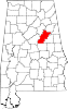 | |
| Towns | ||
| CDPs | ||
|
Unincorporated communities | ||
| Ghost town | ||
| Footnotes | ‡This populated place also has portions in an adjacent county or counties | |
|
| This Talladega County, Alabama state location article is a stub. You can help Wikipedia by expanding it. |
Winterboro, Alabama | |
|---|---|
|
Morriss-Holmes House, taken in 1937 as part of the
Historic American Buildings Survey | |
Winterboro, Alabama Winterboro, Alabama | |
| Coordinates: 33°19′17″N 86°11′49″W / 33.32139°N 86.19694°W | |
| Country | United States |
| State | Alabama |
| County | Talladega |
| Elevation | 509 ft (155 m) |
| Time zone | UTC-6 ( Central (CST)) |
| • Summer ( DST) | UTC-5 (CDT) |
| Area code(s) | 256 & 938 |
| GNIS feature ID | 129128 [1] |
Winterboro, also spelled Winterborough, is an unincorporated community in Talladega County, Alabama, United States.
History
The state of Alabama incorporated the Central Plank Road on January 30, 1850. It was planned to run from Montgomery to Guntersville via Talladega. [2] Joseph Winter planned the road, but the people of Talladega did not give him their expected financial support. As a consequence, Winter ended the plank road at Winterboro and named the settlement for himself. [3] A post office called Winterboro was established in 1853 and remained in operation until 1875. [4] During the Great Depression, the Civilian Conservation Corps cleared brush from pastures around Winterboro. [5] Today, Winterboro is at the junction of Alabama State Route 21 and Alabama State Route 76.
One structure in Winterboro, the Winterboro Stagecoach Inn, is listed on the National Register of Historic Places.
Geography
Winterboro is located in the east central part of the state at 33° 19′ 17″ N, 86° 11′ 49″ W (33.321389 N, -86.196944 W). [6] Alabama State Routes 21 and 76 meet in the community, with AL-21 leading northeast 10 mi (16 km) to Talladega, the county seat, and southwest 11 mi (18 km) to Sylacauga. AL-76 connects the community with Childersburg, 10 mi (16 km) to the southwest.
References
- ^ "Winterboro". Geographic Names Information System. United States Geological Survey, United States Department of the Interior.
- ^ Mallory, James (March 30, 1997). "Fear God and Walk Humbly": The Agricultural Journal of James Mallory, 1843-1877 - James Mallory - Google Books. ISBN 9780817308322. Retrieved November 3, 2014.
- ^ Foscue, Virginia (1989). Place Names in Alabama. Tuscaloosa: The University of Alabama Press. p. 150. ISBN 0-8173-0410-X.
- ^ "Talladega County". Jim Forte Postal History. Retrieved November 3, 2014.
- ^ The Civilian Conservation Corps in Alabama, 1933-1942: A Great and Lasting Good - Robert Pasquill - Google Books. University of Alabama Press. August 5, 2008. ISBN 9780817354954. Retrieved November 3, 2014.
- ^ "GeoHack - Winterboro, Alabama".
Municipalities and communities of
Talladega County, Alabama, United States | ||
|---|---|---|
| Cities | | |
| Towns | ||
| CDPs | ||
|
Unincorporated communities | ||
| Ghost town | ||
| Footnotes | ‡This populated place also has portions in an adjacent county or counties | |
|
| This Talladega County, Alabama state location article is a stub. You can help Wikipedia by expanding it. |