Old Eastaboga, Alabama | |
|---|---|
 Covered Bridge spanning
Choccolocco Creek, taken in 1935 as part of the
Historic American Buildings Survey | |
 Old Eastaboga, Alabama  Old Eastaboga, Alabama | |
| Coordinates: 33°35′11″N 86°01′18″W / 33.58639°N 86.02167°W | |
| Country | United States |
| State | Alabama |
| County | Talladega |
| Elevation | 561 ft (171 m) |
| Time zone | UTC-6 ( Central (CST)) |
| • Summer ( DST) | UTC-5 (CDT) |
| Area code(s) | 256 & 938 |
| GNIS feature ID | 152774 [1] |
Old Eastaboga is an unincorporated community in Talladega County, Alabama, United States. Eastaboga (historically Estaboga) means "where the people reside" in Muscogee. [2] Old Eastaboga was formerly called Eastaboga until the early 20th century, and was briefly listed as an incorporated town on the 1900 and 1910 censuses. The nearby former town of McFall, which was to the north along the railroad, straddling the Talladega and Calhoun County lines, was later renamed Eastaboga (while the original Eastaboga became Old Eastaboga).
Demographics
| Census | Pop. | Note | %± |
|---|---|---|---|
| 1900 | 398 | — | |
| 1910 | 94 | −76.4% | |
| U.S. Decennial Census [3] | |||
Eastaboga (spelled as "Estaboga") was listed on the 1900 and 1910 U.S. Censuses as an incorporated town wholly within Talladega County. It presumably incorporated at or prior to 1900. Given its rapid population decline by 1910, it likely lost its charter at some point during that decade.
Notable people
- Lewis Archer Boswell, aviation pioneer
References
- ^ "Old Eastaboga". Geographic Names Information System. United States Geological Survey, United States Department of the Interior.
- ^ Gannett, Henry (1905). The Origin of Certain Place Names in the United States. Govt. Print. Off. pp. 121.
- ^ "U.S. Decennial Census". Census.gov. Archived from the original on May 7, 2015. Retrieved June 6, 2013.
Municipalities and communities of
Talladega County, Alabama, United States | ||
|---|---|---|
| Cities | 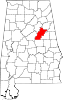 | |
| Towns | ||
| CDPs | ||
|
Unincorporated communities | ||
| Ghost town | ||
| Footnotes | ‡This populated place also has portions in an adjacent county or counties | |
|
| This Talladega County, Alabama state location article is a stub. You can help Wikipedia by expanding it. |
Old Eastaboga, Alabama | |
|---|---|
|
Covered Bridge spanning
Choccolocco Creek, taken in 1935 as part of the
Historic American Buildings Survey | |
Old Eastaboga, Alabama Old Eastaboga, Alabama | |
| Coordinates: 33°35′11″N 86°01′18″W / 33.58639°N 86.02167°W | |
| Country | United States |
| State | Alabama |
| County | Talladega |
| Elevation | 561 ft (171 m) |
| Time zone | UTC-6 ( Central (CST)) |
| • Summer ( DST) | UTC-5 (CDT) |
| Area code(s) | 256 & 938 |
| GNIS feature ID | 152774 [1] |
Old Eastaboga is an unincorporated community in Talladega County, Alabama, United States. Eastaboga (historically Estaboga) means "where the people reside" in Muscogee. [2] Old Eastaboga was formerly called Eastaboga until the early 20th century, and was briefly listed as an incorporated town on the 1900 and 1910 censuses. The nearby former town of McFall, which was to the north along the railroad, straddling the Talladega and Calhoun County lines, was later renamed Eastaboga (while the original Eastaboga became Old Eastaboga).
Demographics
| Census | Pop. | Note | %± |
|---|---|---|---|
| 1900 | 398 | — | |
| 1910 | 94 | −76.4% | |
| U.S. Decennial Census [3] | |||
Eastaboga (spelled as "Estaboga") was listed on the 1900 and 1910 U.S. Censuses as an incorporated town wholly within Talladega County. It presumably incorporated at or prior to 1900. Given its rapid population decline by 1910, it likely lost its charter at some point during that decade.
Notable people
- Lewis Archer Boswell, aviation pioneer
References
- ^ "Old Eastaboga". Geographic Names Information System. United States Geological Survey, United States Department of the Interior.
- ^ Gannett, Henry (1905). The Origin of Certain Place Names in the United States. Govt. Print. Off. pp. 121.
- ^ "U.S. Decennial Census". Census.gov. Archived from the original on May 7, 2015. Retrieved June 6, 2013.
Municipalities and communities of
Talladega County, Alabama, United States | ||
|---|---|---|
| Cities | | |
| Towns | ||
| CDPs | ||
|
Unincorporated communities | ||
| Ghost town | ||
| Footnotes | ‡This populated place also has portions in an adjacent county or counties | |
|
| This Talladega County, Alabama state location article is a stub. You can help Wikipedia by expanding it. |