Wilkinstown
Baile Uilcín | |
|---|---|
Village | |
 Level crossing in Wilkinstown | |
| Coordinates: 53°44′06″N 6°42′42″W / 53.735°N 6.711667°W | |
| Country | Ireland |
| Province | Leinster |
| County | Meath |
| Population (2016)
[1] | 228 |
| (Wilkinstown townland) | |
| Irish grid reference | N851768 |
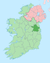
Wilkinstown ( Irish: Baile Uilcín) is a townland and village in north County Meath, Ireland. [2] [3] It is located on the Yellow River and the Navan– Kingscourt road ( R162) about 10 kilometres (6.2 mi) between both Navan and Nobber. Nobber is to the north, Kells is to the west, Navan at the south and Slane at the east.
Amenities
Amenities in Wilkinstown include a pub, community centre, convenience store and service station.[ citation needed] The local national (primary) school, Scoil Naomh Barra, had an enrollment of 226 pupils as of the 2022/2023 school year. [4]
By late 2021, work had commenced on an amenity park and playground, behind the community centre. [5] As of 2022, the track from the Navan–Wilkinstown section of a nearby railway line was also being lifted for the Boyne Valley to Lakelands proposed greenway. [6]
Transport

Wilkinstown railway station, now closed, was on the disused Kingscourt branch of the Dublin–Navan railway line, and was situated in the village centre. At one point it had a signal box, goods store and passing loop; however the signal box was demolished and the passing loop was lifted, but the goods store is still intact, albeit overgrown. The station closed in 1947, with the line closing fully in 2001. [7] The station is now a private residence.
References
- ^ "Sapmap Area - Townlands - Wilkinstown". Census 2016. Central Statistics Office. April 2016. Retrieved 15 May 2022.
- ^ "Baile Uilcín / Wilkinstown". logainm.ie. Placenames Database of Ireland. Retrieved 14 January 2023.
- ^ "Wilkinstown Townland, Co. Meath". townlands.ie.
- ^ "Directory Page - Scoil Naomh Barra (19253K) Wilkinstown National School". Gov.ie. Department of Education. 11 January 2023. Retrieved 14 January 2023.
- ^ "Finishing line in sight for new much-needed amenities in Wilkinstown". MeathChronicle.ie. Meath Chronicle. 22 October 2021. Retrieved 14 January 2023.
- ^ "Boyne Valley to Lakelands Greenway | Discover Boyne Valley Meath, Ireland". DiscoverBoyneValley.ie.
- ^ "Wilkinstown". EireTrains.com.
Wilkinstown
Baile Uilcín | |
|---|---|
Village | |
 Level crossing in Wilkinstown | |
| Coordinates: 53°44′06″N 6°42′42″W / 53.735°N 6.711667°W | |
| Country | Ireland |
| Province | Leinster |
| County | Meath |
| Population (2016)
[1] | 228 |
| (Wilkinstown townland) | |
| Irish grid reference | N851768 |
Wilkinstown ( Irish: Baile Uilcín) is a townland and village in north County Meath, Ireland. [2] [3] It is located on the Yellow River and the Navan– Kingscourt road ( R162) about 10 kilometres (6.2 mi) between both Navan and Nobber. Nobber is to the north, Kells is to the west, Navan at the south and Slane at the east.
Amenities
Amenities in Wilkinstown include a pub, community centre, convenience store and service station.[ citation needed] The local national (primary) school, Scoil Naomh Barra, had an enrollment of 226 pupils as of the 2022/2023 school year. [4]
By late 2021, work had commenced on an amenity park and playground, behind the community centre. [5] As of 2022, the track from the Navan–Wilkinstown section of a nearby railway line was also being lifted for the Boyne Valley to Lakelands proposed greenway. [6]
Transport

Wilkinstown railway station, now closed, was on the disused Kingscourt branch of the Dublin–Navan railway line, and was situated in the village centre. At one point it had a signal box, goods store and passing loop; however the signal box was demolished and the passing loop was lifted, but the goods store is still intact, albeit overgrown. The station closed in 1947, with the line closing fully in 2001. [7] The station is now a private residence.
References
- ^ "Sapmap Area - Townlands - Wilkinstown". Census 2016. Central Statistics Office. April 2016. Retrieved 15 May 2022.
- ^ "Baile Uilcín / Wilkinstown". logainm.ie. Placenames Database of Ireland. Retrieved 14 January 2023.
- ^ "Wilkinstown Townland, Co. Meath". townlands.ie.
- ^ "Directory Page - Scoil Naomh Barra (19253K) Wilkinstown National School". Gov.ie. Department of Education. 11 January 2023. Retrieved 14 January 2023.
- ^ "Finishing line in sight for new much-needed amenities in Wilkinstown". MeathChronicle.ie. Meath Chronicle. 22 October 2021. Retrieved 14 January 2023.
- ^ "Boyne Valley to Lakelands Greenway | Discover Boyne Valley Meath, Ireland". DiscoverBoyneValley.ie.
- ^ "Wilkinstown". EireTrains.com.

