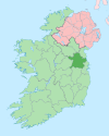
Boyerstown ( Irish: Baile Bháigh) [1] is a townland in County Meath, Ireland. It is located off the N51 national secondary road 5 kilometres (3 mi) southwest of Navan. The M3 motorway runs through the townland.
The parish of Boyerstown, along with another parish called Cortown, historically has been linked to the neighbouring parish of Bohermeen, with the parish priest and curate serving all three parishes.
See also
References
- ^ "Baile Bháigh/Boyerstown". logainm.ie. Retrieved 5 January 2023.
External links
- Archaeological discoveries while building the N3 in Boyerstown
- More archaeological discoveries while planning the road
- Architecture link showing a historic thatched house in Boyerstown
53°38′06″N 6°45′03″W / 53.63500°N 6.75083°W
