Photos • Location

Moylagh Castle in June 2013

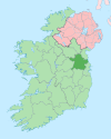
Moylagh ( Irish: Maigh Locha, meaning "plain of the lake") [1] is a civil parish and townland in the northwest of County Meath, Ireland. [2] The townland Moylagh lies within the Roman Catholic parish of Oldcastle and Moylagh. [3]
See also
- Drumone, village within the civil parish of Moylagh
- Gortloney, nearby townland also in the civil parish of Moylagh
References
- ^ "Maigh Locha / Moylagh". logainm.ie. Irish Placenames Commission. Retrieved 16 February 2020.
- ^ "Moylagh Townland, Co. Meath". townlands.ie. Retrieved 16 February 2020.
- ^ "About Us". oldcastleandmoylaghparish.com. Oldcastle and Moylagh Parish. Retrieved 16 February 2020.
53°43′31″N 7°11′23″W / 53.72528°N 7.18972°W
