Photos • Location

You can help expand this article with text translated from
the corresponding article in Serbian. (September 2011) Click [show] for important translation instructions.
|
Tabanović
Табановић | |
|---|---|
| Nickname: Tabby | |
| Country | |
| District | Kolubara District |
| Municipality | Mionica |
| Time zone | UTC+1 ( CET) |
| • Summer ( DST) | UTC+2 ( CEST) |
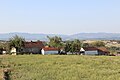
Tabanović is a village situated in the Mionica municipality in Serbia. [1]
-
 Tabanović - Panorama
 -
 Tabanović - Panorama
 -
 Tabanović - Panorama
 -
 Tabanović - Panorama
 -
 Tabanović - Panorama
 -
 Tabanović - Panorama
 -
 Tabanović - Panorama
 -
 Tabanović - Panorama


References
- ^ Institut national d'études démographique (INED) Archived 2014-07-02 at the Wayback Machine
44°17′04″N 20°05′09″E / 44.28444°N 20.08583°E
|
| This Kolubara District, Serbia location article is a stub. You can help Wikipedia by expanding it. |
You can help expand this article with text translated from
the corresponding article in Serbian. (September 2011) Click [show] for important translation instructions.
|
Tabanović
Табановић | |
|---|---|
| Nickname: Tabby | |
| Country | |
| District | Kolubara District |
| Municipality | Mionica |
| Time zone | UTC+1 ( CET) |
| • Summer ( DST) | UTC+2 ( CEST) |
Tabanović is a village situated in the Mionica municipality in Serbia. [1]
-
Tabanović - Panorama
-
Tabanović - Panorama
-
Tabanović - Panorama
-
Tabanović - Panorama
-
Tabanović - Panorama
-
Tabanović - Panorama
-
Tabanović - Panorama
-
Tabanović - Panorama
References
- ^ Institut national d'études démographique (INED) Archived 2014-07-02 at the Wayback Machine
44°17′04″N 20°05′09″E / 44.28444°N 20.08583°E
|
| This Kolubara District, Serbia location article is a stub. You can help Wikipedia by expanding it. |