Photos • Location
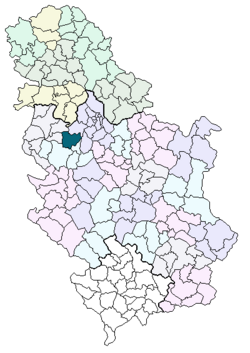
Location of the Ub municipality in
Serbia


Radljevo | |
|---|---|
 Radljevo | |
| Coordinates: 44°29′48″N 20°10′14″E / 44.49667°N 20.17056°E | |
| Country | |
| Municipality | Ub |
| Area | |
| • Total | 11.83 km2 (4.57 sq mi) |
| Elevation | 108 m (354 ft) |
| Population (2011) | |
| • Total | 611 |
| • Density | 52/km2 (130/sq mi) |
| Time zone | UTC+1 ( CET) |
| • Summer ( DST) | UTC+2 ( CEST) |
Radljevo ( Serbian Cyrillic: Радљево) is a village in Serbia. It is situated in the Ub municipality, in the Kolubara District of Central Serbia. The village has a population of 611 inhabitants, as of 2011 census.

Historical population
- 1948: 1165
- 1953: 1172
- 1961: 1136
- 1971: 948
- 1981: 774
- 1991: 677
- 2002: 607
References
- ^ In Serbian Књига 9, Становништво, упоредни преглед броја становника 1948, 1953, 1961, 1971, 1981, 1991, 2002, подаци по насељима, Републички завод за статистику, Београд, мај 2004, ISBN 86-84433-14-9
See also
44°29′48″N 20°10′14″E / 44.49667°N 20.17056°E
|
| This Kolubara District, Serbia location article is a stub. You can help Wikipedia by expanding it. |
Wikimedia Commons has media related to
Radljevo.
Radljevo | |
|---|---|
Radljevo | |
| Coordinates: 44°29′48″N 20°10′14″E / 44.49667°N 20.17056°E | |
| Country | |
| Municipality | Ub |
| Area | |
| • Total | 11.83 km2 (4.57 sq mi) |
| Elevation | 108 m (354 ft) |
| Population (2011) | |
| • Total | 611 |
| • Density | 52/km2 (130/sq mi) |
| Time zone | UTC+1 ( CET) |
| • Summer ( DST) | UTC+2 ( CEST) |
Radljevo ( Serbian Cyrillic: Радљево) is a village in Serbia. It is situated in the Ub municipality, in the Kolubara District of Central Serbia. The village has a population of 611 inhabitants, as of 2011 census.
Historical population
- 1948: 1165
- 1953: 1172
- 1961: 1136
- 1971: 948
- 1981: 774
- 1991: 677
- 2002: 607
References
- ^ In Serbian Књига 9, Становништво, упоредни преглед броја становника 1948, 1953, 1961, 1971, 1981, 1991, 2002, подаци по насељима, Републички завод за статистику, Београд, мај 2004, ISBN 86-84433-14-9
See also
44°29′48″N 20°10′14″E / 44.49667°N 20.17056°E
|
| This Kolubara District, Serbia location article is a stub. You can help Wikipedia by expanding it. |
Wikimedia Commons has media related to
Radljevo.