Photos • Location
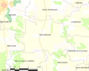
Saint-Médard and its surrounding communes


Saint-Médard | |
|---|---|
 Saint-Médard  Saint-Médard | |
| Coordinates: 43°29′28″N 0°27′37″E / 43.4911°N 0.4603°E | |
| Country | France |
| Region | Occitania |
| Department | Gers |
| Arrondissement | Mirande |
| Canton | Mirande-Astarac |
| Government | |
| • Mayor (2020–2026) | Annie Bourdallé [1] |
| Area 1 | 17.07 km2 (6.59 sq mi) |
| Population (2021)
[2] | 343 |
| • Density | 20/km2 (52/sq mi) |
| Time zone | UTC+01:00 ( CET) |
| • Summer ( DST) | UTC+02:00 ( CEST) |
| INSEE/Postal code |
32394 /32300 |
| Elevation | 165–281 m (541–922 ft) (avg. 182 m or 597 ft) |
| 1 French Land Register data, which excludes lakes, ponds, glaciers > 1 km2 (0.386 sq mi or 247 acres) and river estuaries. | |
Saint-Médard (French pronunciation: [sɛ̃ medaʁ]; Gascon: Sent Mesard) is a commune in the Gers department in southwestern France.
The Petite Baïse forms part of the commune's southern border, flows north through the middle of the commune, then forms part of its northern border.

| Year | Pop. | ±% |
|---|---|---|
| 1962 | 338 | — |
| 1968 | 282 | −16.6% |
| 1975 | 281 | −0.4% |
| 1982 | 274 | −2.5% |
| 1990 | 277 | +1.1% |
| 1999 | 293 | +5.8% |
| 2008 | 338 | +15.4% |
- ^ "Répertoire national des élus: les maires". data.gouv.fr, Plateforme ouverte des données publiques françaises (in French). 2 December 2020.
- ^ "Populations légales 2021" (in French). The National Institute of Statistics and Economic Studies. 28 December 2023.
Wikimedia Commons has media related to
Saint-Médard (Gers).
| Authority control databases: National |
|---|
|
| This Gers geographical article is a stub. You can help Wikipedia by expanding it. |
Saint-Médard | |
|---|---|
Saint-Médard Saint-Médard | |
| Coordinates: 43°29′28″N 0°27′37″E / 43.4911°N 0.4603°E | |
| Country | France |
| Region | Occitania |
| Department | Gers |
| Arrondissement | Mirande |
| Canton | Mirande-Astarac |
| Government | |
| • Mayor (2020–2026) | Annie Bourdallé [1] |
| Area 1 | 17.07 km2 (6.59 sq mi) |
| Population (2021)
[2] | 343 |
| • Density | 20/km2 (52/sq mi) |
| Time zone | UTC+01:00 ( CET) |
| • Summer ( DST) | UTC+02:00 ( CEST) |
| INSEE/Postal code |
32394 /32300 |
| Elevation | 165–281 m (541–922 ft) (avg. 182 m or 597 ft) |
| 1 French Land Register data, which excludes lakes, ponds, glaciers > 1 km2 (0.386 sq mi or 247 acres) and river estuaries. | |
Saint-Médard (French pronunciation: [sɛ̃ medaʁ]; Gascon: Sent Mesard) is a commune in the Gers department in southwestern France.
The Petite Baïse forms part of the commune's southern border, flows north through the middle of the commune, then forms part of its northern border.
| Year | Pop. | ±% |
|---|---|---|
| 1962 | 338 | — |
| 1968 | 282 | −16.6% |
| 1975 | 281 | −0.4% |
| 1982 | 274 | −2.5% |
| 1990 | 277 | +1.1% |
| 1999 | 293 | +5.8% |
| 2008 | 338 | +15.4% |
- ^ "Répertoire national des élus: les maires". data.gouv.fr, Plateforme ouverte des données publiques françaises (in French). 2 December 2020.
- ^ "Populations légales 2021" (in French). The National Institute of Statistics and Economic Studies. 28 December 2023.
Wikimedia Commons has media related to
Saint-Médard (Gers).
| Authority control databases: National |
|---|
|
| This Gers geographical article is a stub. You can help Wikipedia by expanding it. |