Photos • Location
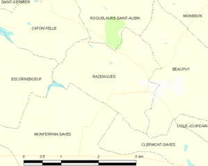
Razengues and its surrounding communes


Razengues | |
|---|---|
.svg) Coat of arms | |
 Razengues  Razengues | |
| Coordinates: 43°38′32″N 0°59′53″E / 43.6422°N 0.9981°E | |
| Country | France |
| Region | Occitania |
| Department | Gers |
| Arrondissement | Auch |
| Canton | Gimone-Arrats |
| Government | |
| • Mayor (2020–2026) | Janine Barioulet-Lahirle [1] |
| Area 1 | 4.35 km2 (1.68 sq mi) |
| Population (2021)
[2] | 249 |
| • Density | 57/km2 (150/sq mi) |
| Time zone | UTC+01:00 ( CET) |
| • Summer ( DST) | UTC+02:00 ( CEST) |
| INSEE/Postal code |
32339 /32600 |
| Elevation | 178–231 m (584–758 ft) (avg. 147 m or 482 ft) |
| 1 French Land Register data, which excludes lakes, ponds, glaciers > 1 km2 (0.386 sq mi or 247 acres) and river estuaries. | |
Razengues is a commune in the Gers department in southwestern France.
Geography

Population
| Year | Pop. | ±% p.a. |
|---|---|---|
| 1968 | 96 | — |
| 1975 | 95 | −0.15% |
| 1982 | 84 | −1.74% |
| 1990 | 93 | +1.28% |
| 1999 | 104 | +1.25% |
| 2009 | 189 | +6.16% |
| 2014 | 229 | +3.91% |
| 2020 | 251 | +1.54% |
| Source: INSEE [3] | ||
See also
References
- ^ "Répertoire national des élus: les maires". data.gouv.fr, Plateforme ouverte des données publiques françaises (in French). 9 August 2021.
- ^ "Populations légales 2021" (in French). The National Institute of Statistics and Economic Studies. 28 December 2023.
- ^ Population en historique depuis 1968, INSEE
Wikimedia Commons has media related to
Razengues.
| Authority control databases: National |
|---|
|
| This Gers geographical article is a stub. You can help Wikipedia by expanding it. |
Razengues | |
|---|---|
|
Coat of arms | |
Razengues Razengues | |
| Coordinates: 43°38′32″N 0°59′53″E / 43.6422°N 0.9981°E | |
| Country | France |
| Region | Occitania |
| Department | Gers |
| Arrondissement | Auch |
| Canton | Gimone-Arrats |
| Government | |
| • Mayor (2020–2026) | Janine Barioulet-Lahirle [1] |
| Area 1 | 4.35 km2 (1.68 sq mi) |
| Population (2021)
[2] | 249 |
| • Density | 57/km2 (150/sq mi) |
| Time zone | UTC+01:00 ( CET) |
| • Summer ( DST) | UTC+02:00 ( CEST) |
| INSEE/Postal code |
32339 /32600 |
| Elevation | 178–231 m (584–758 ft) (avg. 147 m or 482 ft) |
| 1 French Land Register data, which excludes lakes, ponds, glaciers > 1 km2 (0.386 sq mi or 247 acres) and river estuaries. | |
Razengues is a commune in the Gers department in southwestern France.
Geography
Population
| Year | Pop. | ±% p.a. |
|---|---|---|
| 1968 | 96 | — |
| 1975 | 95 | −0.15% |
| 1982 | 84 | −1.74% |
| 1990 | 93 | +1.28% |
| 1999 | 104 | +1.25% |
| 2009 | 189 | +6.16% |
| 2014 | 229 | +3.91% |
| 2020 | 251 | +1.54% |
| Source: INSEE [3] | ||
See also
References
- ^ "Répertoire national des élus: les maires". data.gouv.fr, Plateforme ouverte des données publiques françaises (in French). 9 August 2021.
- ^ "Populations légales 2021" (in French). The National Institute of Statistics and Economic Studies. 28 December 2023.
- ^ Population en historique depuis 1968, INSEE
Wikimedia Commons has media related to
Razengues.
| Authority control databases: National |
|---|
|
| This Gers geographical article is a stub. You can help Wikipedia by expanding it. |