Photos • Location
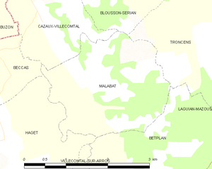
Malabat and its surrounding communes


Malabat | |
|---|---|
 Malabat  Malabat | |
| Coordinates: 43°26′03″N 0°11′11″E / 43.4342°N 0.1864°E | |
| Country | France |
| Region | Occitania |
| Department | Gers |
| Arrondissement | Mirande |
| Canton | Mirande-Astarac |
| Government | |
| • Mayor (2020–2026) | Céline Salles [1] |
| Area 1 | 5.4 km2 (2.1 sq mi) |
| Population (2021)
[2] | 100 |
| • Density | 19/km2 (48/sq mi) |
| Time zone | UTC+01:00 ( CET) |
| • Summer ( DST) | UTC+02:00 ( CEST) |
| INSEE/Postal code |
32225 /32730 |
| Elevation | 162–296 m (531–971 ft) (avg. 200 m or 660 ft) |
| 1 French Land Register data, which excludes lakes, ponds, glaciers > 1 km2 (0.386 sq mi or 247 acres) and river estuaries. | |
Malabat is a commune in the Gers department in southwestern France.
Geography

Population
| Year | Pop. | ±% |
|---|---|---|
| 1962 | 100 | — |
| 1968 | 81 | −19.0% |
| 1975 | 95 | +17.3% |
| 1982 | 94 | −1.1% |
| 1990 | 89 | −5.3% |
| 1999 | 87 | −2.2% |
| 2008 | 97 | +11.5% |
See also
References
- ^ "Répertoire national des élus: les maires". data.gouv.fr, Plateforme ouverte des données publiques françaises (in French). 2 December 2020.
- ^ "Populations légales 2021" (in French). The National Institute of Statistics and Economic Studies. 28 December 2023.
Wikimedia Commons has media related to
Malabat.
| Authority control databases: National |
|---|
|
| This Gers geographical article is a stub. You can help Wikipedia by expanding it. |
Malabat | |
|---|---|
Malabat Malabat | |
| Coordinates: 43°26′03″N 0°11′11″E / 43.4342°N 0.1864°E | |
| Country | France |
| Region | Occitania |
| Department | Gers |
| Arrondissement | Mirande |
| Canton | Mirande-Astarac |
| Government | |
| • Mayor (2020–2026) | Céline Salles [1] |
| Area 1 | 5.4 km2 (2.1 sq mi) |
| Population (2021)
[2] | 100 |
| • Density | 19/km2 (48/sq mi) |
| Time zone | UTC+01:00 ( CET) |
| • Summer ( DST) | UTC+02:00 ( CEST) |
| INSEE/Postal code |
32225 /32730 |
| Elevation | 162–296 m (531–971 ft) (avg. 200 m or 660 ft) |
| 1 French Land Register data, which excludes lakes, ponds, glaciers > 1 km2 (0.386 sq mi or 247 acres) and river estuaries. | |
Malabat is a commune in the Gers department in southwestern France.
Geography
Population
| Year | Pop. | ±% |
|---|---|---|
| 1962 | 100 | — |
| 1968 | 81 | −19.0% |
| 1975 | 95 | +17.3% |
| 1982 | 94 | −1.1% |
| 1990 | 89 | −5.3% |
| 1999 | 87 | −2.2% |
| 2008 | 97 | +11.5% |
See also
References
- ^ "Répertoire national des élus: les maires". data.gouv.fr, Plateforme ouverte des données publiques françaises (in French). 2 December 2020.
- ^ "Populations légales 2021" (in French). The National Institute of Statistics and Economic Studies. 28 December 2023.
Wikimedia Commons has media related to
Malabat.
| Authority control databases: National |
|---|
|
| This Gers geographical article is a stub. You can help Wikipedia by expanding it. |