Photos • Location
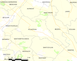
Polastron and its surrounding communes


Polastron | |
|---|---|
 Polastron  Polastron | |
| Coordinates: 43°31′56″N 0°50′44″E / 43.5322°N 0.8456°E | |
| Country | France |
| Region | Occitania |
| Department | Gers |
| Arrondissement | Auch |
| Canton | Val de Save |
| Intercommunality | Savès |
| Government | |
| • Mayor (2020–2026) | Alain Laffiteau [1] |
| Area 1 | 15.21 km2 (5.87 sq mi) |
| Population (2021)
[2] | 276 |
| • Density | 18/km2 (47/sq mi) |
| Time zone | UTC+01:00 ( CET) |
| • Summer ( DST) | UTC+02:00 ( CEST) |
| INSEE/Postal code |
32321 /32130 |
| Elevation | 171–286 m (561–938 ft) (avg. 192 m or 630 ft) |
| 1 French Land Register data, which excludes lakes, ponds, glaciers > 1 km2 (0.386 sq mi or 247 acres) and river estuaries. | |
Polastron (French pronunciation: [pɔlastʁɔ̃]) is a commune in the Gers department in southwestern France.

| Year | Pop. | ±% |
|---|---|---|
| 1962 | 302 | — |
| 1968 | 231 | −23.5% |
| 1975 | 198 | −14.3% |
| 1982 | 191 | −3.5% |
| 1990 | 191 | +0.0% |
| 1999 | 188 | −1.6% |
| 2008 | 242 | +28.7% |
- ^ "Répertoire national des élus: les maires". data.gouv.fr, Plateforme ouverte des données publiques françaises (in French). 2 December 2020.
- ^ "Populations légales 2021" (in French). The National Institute of Statistics and Economic Studies. 28 December 2023.
Wikimedia Commons has media related to
Polastron (Gers).
| Authority control databases: National |
|---|
|
| This Gers geographical article is a stub. You can help Wikipedia by expanding it. |
Polastron | |
|---|---|
Polastron Polastron | |
| Coordinates: 43°31′56″N 0°50′44″E / 43.5322°N 0.8456°E | |
| Country | France |
| Region | Occitania |
| Department | Gers |
| Arrondissement | Auch |
| Canton | Val de Save |
| Intercommunality | Savès |
| Government | |
| • Mayor (2020–2026) | Alain Laffiteau [1] |
| Area 1 | 15.21 km2 (5.87 sq mi) |
| Population (2021)
[2] | 276 |
| • Density | 18/km2 (47/sq mi) |
| Time zone | UTC+01:00 ( CET) |
| • Summer ( DST) | UTC+02:00 ( CEST) |
| INSEE/Postal code |
32321 /32130 |
| Elevation | 171–286 m (561–938 ft) (avg. 192 m or 630 ft) |
| 1 French Land Register data, which excludes lakes, ponds, glaciers > 1 km2 (0.386 sq mi or 247 acres) and river estuaries. | |
Polastron (French pronunciation: [pɔlastʁɔ̃]) is a commune in the Gers department in southwestern France.
| Year | Pop. | ±% |
|---|---|---|
| 1962 | 302 | — |
| 1968 | 231 | −23.5% |
| 1975 | 198 | −14.3% |
| 1982 | 191 | −3.5% |
| 1990 | 191 | +0.0% |
| 1999 | 188 | −1.6% |
| 2008 | 242 | +28.7% |
- ^ "Répertoire national des élus: les maires". data.gouv.fr, Plateforme ouverte des données publiques françaises (in French). 2 December 2020.
- ^ "Populations légales 2021" (in French). The National Institute of Statistics and Economic Studies. 28 December 2023.
Wikimedia Commons has media related to
Polastron (Gers).
| Authority control databases: National |
|---|
|
| This Gers geographical article is a stub. You can help Wikipedia by expanding it. |