Photos • Location
(Redirected from
Huriwaa District)
Huriwa | |
|---|---|
 | |
| Coordinates: 2°02′00″N 45°21′00″E / 2.0333°N 45.3500°E | |
| Country | |
| Region | Banaadir |
| Time zone | UTC+3 ( EAT) |
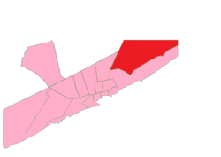
Huriwa District ( Somali: Degmada Huriwaa) is a district in the southeastern Banaadir region of Somalia and . It includes the northeastern neighborhoods of the national capital, Mogadishu.
(Redirected from
Huriwaa District)
Huriwa | |
|---|---|
 | |
| Coordinates: 2°02′00″N 45°21′00″E / 2.0333°N 45.3500°E | |
| Country | |
| Region | Banaadir |
| Time zone | UTC+3 ( EAT) |
Huriwa District ( Somali: Degmada Huriwaa) is a district in the southeastern Banaadir region of Somalia and . It includes the northeastern neighborhoods of the national capital, Mogadishu.