Photos • Location
Location of
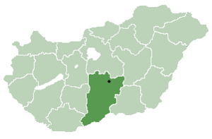
Bács-Kiskun county in
Hungary

Harkakötöny | |
|---|---|
| Country | |
| County | Bács-Kiskun |
| Area | |
| • Total | 52.70 km2 (20.35 sq mi) |
| Population (2002) | |
| • Total | 1,014 |
| • Density | 19/km2 (50/sq mi) |
| Time zone | UTC+1 ( CET) |
| • Summer ( DST) | UTC+2 ( CEST) |
| Postal code | 6136 |
| Area code | 77 |

Harkakötöny is a village in Bács-Kiskun county, in the Southern Great Plain region of southern Hungary.
Croats in Hungary call this village Kotinj. [1]
Geography
It covers an area of 52.7 km2 (20 sq mi) and has a population of 1014 people (2005).
References
- ^ "Folia onomastica croatica 14/2005" (in Croatian). (462 KB) Živko Mandić: Hrvatska imena naseljenih mjesta u Madžarskoj,


46°27′N 19°36′E / 46.450°N 19.600°E
|
| This Bács-Kiskun location article is a stub. You can help Wikipedia by expanding it. |
Harkakötöny | |
|---|---|
| Country | |
| County | Bács-Kiskun |
| Area | |
| • Total | 52.70 km2 (20.35 sq mi) |
| Population (2002) | |
| • Total | 1,014 |
| • Density | 19/km2 (50/sq mi) |
| Time zone | UTC+1 ( CET) |
| • Summer ( DST) | UTC+2 ( CEST) |
| Postal code | 6136 |
| Area code | 77 |
Harkakötöny is a village in Bács-Kiskun county, in the Southern Great Plain region of southern Hungary.
Croats in Hungary call this village Kotinj. [1]
Geography
It covers an area of 52.7 km2 (20 sq mi) and has a population of 1014 people (2005).
References
- ^ "Folia onomastica croatica 14/2005" (in Croatian). (462 KB) Živko Mandić: Hrvatska imena naseljenih mjesta u Madžarskoj,
46°27′N 19°36′E / 46.450°N 19.600°E
|
| This Bács-Kiskun location article is a stub. You can help Wikipedia by expanding it. |