Photos • Location

Fülöpszállás | |
|---|---|
 Kostök-holtág | |
 Coat of arms | |
 Location of
Bács-Kiskun county in
Hungary | |
| Coordinates: 46°49′15.6″N 19°14′6″E / 46.821000°N 19.23500°E | |
| Country | |
| County | Bács-Kiskun |
| Area | |
| • Total | 104.94 km2 (40.52 sq mi) |
| Population (2005) | |
| • Total | 1,657 |
| • Density | 15.78/km2 (40.9/sq mi) |
| Time zone | UTC+1 ( CET) |
| • Summer ( DST) | UTC+2 ( CEST) |
| Postal code | 6085 |
| Area code | 78 |
Fülöpszállás is a village in Bács-Kiskun county, in the Southern Great Plain region of southern Hungary.
Geography
It covers an area of 104.94 km2 (41 sq mi) and has a population of 1657 people (2005).
Gallery
-

-
 Primary school
 -
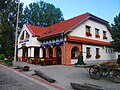 Kígyósi Csárda
 -
 Kecskemet-Fülöpszállás railway plaque
 -
 Church
 -
 Monument of hungarian revolution of 1956


|
| This Bács-Kiskun location article is a stub. You can help Wikipedia by expanding it. |
Fülöpszállás | |
|---|---|
|
Kostök-holtág | |
|
Coat of arms | |
|
Location of
Bács-Kiskun county in
Hungary | |
| Coordinates: 46°49′15.6″N 19°14′6″E / 46.821000°N 19.23500°E | |
| Country | |
| County | Bács-Kiskun |
| Area | |
| • Total | 104.94 km2 (40.52 sq mi) |
| Population (2005) | |
| • Total | 1,657 |
| • Density | 15.78/km2 (40.9/sq mi) |
| Time zone | UTC+1 ( CET) |
| • Summer ( DST) | UTC+2 ( CEST) |
| Postal code | 6085 |
| Area code | 78 |
Fülöpszállás is a village in Bács-Kiskun county, in the Southern Great Plain region of southern Hungary.
Geography
It covers an area of 104.94 km2 (41 sq mi) and has a population of 1657 people (2005).
Gallery
-
-
Primary school
-
Kígyósi Csárda
-
Kecskemet-Fülöpszállás railway plaque
-
Church
-
Monument of hungarian revolution of 1956
|
| This Bács-Kiskun location article is a stub. You can help Wikipedia by expanding it. |