This article relies largely or entirely on a
single source. (February 2017) |
Fehérgyarmat District
Fehérgyarmati járás | |
|---|---|
 Coat of arms | |
 Fehérgyarmat District within Hungary and Szabolcs-Szatmár-Bereg County. | |
| Country | |
| County | Szabolcs-Szatmár-Bereg |
| District seat | Fehérgyarmat |
| Area | |
| • Total | 707.37 km2 (273.12 sq mi) |
| • Rank | 2nd in Szabolcs-Szatmár-Bereg |
| Population (2011 census) | |
| • Total | 37,259 |
| • Rank | 5th in Szabolcs-Szatmár-Bereg |
| • Density | 53/km2 (140/sq mi) |
Fehérgyarmat ( Hungarian: Fehérgyarmati járás) is a district in eastern part of Szabolcs-Szatmár-Bereg County. Fehérgyarmat is also the name of the town where the district seat is found. The district is located in the Northern Great Plain Statistical Region. This district is a part of Szatmár historical and geographical region.
Geography
Fehérgyarmat District borders with Vásárosnamény District and the Ukrainian oblast of Zakarpattia to the north, Romanian county of Satu Mare to the east, Csenger District to the south, Mátészalka District to the west. The number of the inhabited places in Fehérgyarmat District is 50.
Municipalities
The district has 1 town, 2 large villages and 47 villages. (ordered by population, as of 1 January 2013) [1]
- Botpalád (654)
- Cégénydányád (640)
- Csaholc (544)
- Császló (346)
- Csegöld (640)
- Darnó (169)
- Fehérgyarmat (7,967) – district seat
- Fülesd (446)
- Gacsály (898)
- Garbolc (154)
- Gyügye (240)
- Hermánszeg (240)
- Jánkmajtis (1,710)
- Kérsemjén (309)
- Kisar (1,076)
- Kishódos (79)
- Kisnamény (309)
- Kispalád (580)
- Kisszekeres (580)
- Kölcse (1,360)
- Kömörő (569)
- Magosliget (283)
- Mánd (254)
- Méhtelek (732)
- Milota (910)
- Nábrád (911)
- Nagyar (679)
- Nagyhódos (109)
- Nagyszekeres (557)
- Nemesborzova (85)
- Olcsvaapáti (281)
- Panyola (616)
- Penyige (731)
- Rozsály (814)
- Sonkád (723)
- Szamossályi (725)
- Szamosújlak (363)
- Szatmárcseke (1,508)
- Tiszabecs (1,111)
- Tiszacsécse (237)
- Tiszakóród (740)
- Tisztaberek (693)
- Tivadar (167)
- Tunyogmatolcs (2,466)
- Túristvándi (762)
- Túrricse (668)
- Uszka (427)
- Vámosoroszi (515)
- Zajta (406)
- Zsarolyán (380)
The bolded municipality is city, italics municipalities are large villages.
Demographics
Religion in Fehérgyarmat District (2011 census)
In 2011, it had a population of 37,259 and the population density was 53/km².
| Year | County population [2] | Change |
|---|---|---|
| 2011 | 37,259 | n/a |
Ethnicity
Besides the Hungarian majority, the main minorities are the Roma (approx. 4,500), Ukrainian, Romanian and German (150).
Total population (2011 census): 37,259
Ethnic groups (2011 census):
[3] Identified themselves: 38,367 persons:
- Hungarians: 33,254 (86.67%)
- Gypsies: 4,578 (11.93%)
- Others and indefinable: 535 (1.39%)
Approx. 1,000 persons in Fehérgyarmat District did declare more than one ethnic group at the 2011 census.
Religion
Religious adherence in the county according to 2011 census: [4]
- Reformed – 23,258;
- Catholic – 4,798 ( Roman Catholic – 2,951; Greek Catholic – 1,847);
- Evangelical – 327;
- Orthodox – 39;
- other religions – 994;
- Non-religious – 1,935;
- Atheism – 80;
- Undeclared – 5,828.
Gallery
-
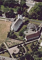 Fehérgyarmat, the district seat
 -
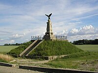 Turul Monument in Tiszabecs
 -
 Watermill of Túristvándi
 -
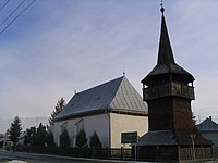 Wooden bell tower of Kölcse


See also
References
- ^ A KSH 2013. évi helységnévkönyve
- ^ népesség.com, "Fehérgyarmati járás népessége"
- ^ 4.1.6.1 A népesség nemzetiség szerint, 2011, (in Hungarian) [1]
- ^ 4.1.7.1 A népesség vallás, felekezet szerint, 2011, (in Hungarian) [2]
External links
| Town (1) |
| |
|---|---|---|
| Large villages (2) | ||
| Villages (47) |
| |
48°00′00″N 22°40′00″E / 48.0000°N 22.6667°E
|
| This Szabolcs-Szatmár-Bereg location article is a stub. You can help Wikipedia by expanding it. |
This article relies largely or entirely on a
single source. (February 2017) |
Fehérgyarmat District
Fehérgyarmati járás | |
|---|---|
|
Coat of arms | |
|
Fehérgyarmat District within Hungary and Szabolcs-Szatmár-Bereg County. | |
| Country | |
| County | Szabolcs-Szatmár-Bereg |
| District seat | Fehérgyarmat |
| Area | |
| • Total | 707.37 km2 (273.12 sq mi) |
| • Rank | 2nd in Szabolcs-Szatmár-Bereg |
| Population (2011 census) | |
| • Total | 37,259 |
| • Rank | 5th in Szabolcs-Szatmár-Bereg |
| • Density | 53/km2 (140/sq mi) |
Fehérgyarmat ( Hungarian: Fehérgyarmati járás) is a district in eastern part of Szabolcs-Szatmár-Bereg County. Fehérgyarmat is also the name of the town where the district seat is found. The district is located in the Northern Great Plain Statistical Region. This district is a part of Szatmár historical and geographical region.
Geography
Fehérgyarmat District borders with Vásárosnamény District and the Ukrainian oblast of Zakarpattia to the north, Romanian county of Satu Mare to the east, Csenger District to the south, Mátészalka District to the west. The number of the inhabited places in Fehérgyarmat District is 50.
Municipalities
The district has 1 town, 2 large villages and 47 villages. (ordered by population, as of 1 January 2013) [1]
- Botpalád (654)
- Cégénydányád (640)
- Csaholc (544)
- Császló (346)
- Csegöld (640)
- Darnó (169)
- Fehérgyarmat (7,967) – district seat
- Fülesd (446)
- Gacsály (898)
- Garbolc (154)
- Gyügye (240)
- Hermánszeg (240)
- Jánkmajtis (1,710)
- Kérsemjén (309)
- Kisar (1,076)
- Kishódos (79)
- Kisnamény (309)
- Kispalád (580)
- Kisszekeres (580)
- Kölcse (1,360)
- Kömörő (569)
- Magosliget (283)
- Mánd (254)
- Méhtelek (732)
- Milota (910)
- Nábrád (911)
- Nagyar (679)
- Nagyhódos (109)
- Nagyszekeres (557)
- Nemesborzova (85)
- Olcsvaapáti (281)
- Panyola (616)
- Penyige (731)
- Rozsály (814)
- Sonkád (723)
- Szamossályi (725)
- Szamosújlak (363)
- Szatmárcseke (1,508)
- Tiszabecs (1,111)
- Tiszacsécse (237)
- Tiszakóród (740)
- Tisztaberek (693)
- Tivadar (167)
- Tunyogmatolcs (2,466)
- Túristvándi (762)
- Túrricse (668)
- Uszka (427)
- Vámosoroszi (515)
- Zajta (406)
- Zsarolyán (380)
The bolded municipality is city, italics municipalities are large villages.
Demographics
Religion in Fehérgyarmat District (2011 census)
In 2011, it had a population of 37,259 and the population density was 53/km².
| Year | County population [2] | Change |
|---|---|---|
| 2011 | 37,259 | n/a |
Ethnicity
Besides the Hungarian majority, the main minorities are the Roma (approx. 4,500), Ukrainian, Romanian and German (150).
Total population (2011 census): 37,259
Ethnic groups (2011 census):
[3] Identified themselves: 38,367 persons:
- Hungarians: 33,254 (86.67%)
- Gypsies: 4,578 (11.93%)
- Others and indefinable: 535 (1.39%)
Approx. 1,000 persons in Fehérgyarmat District did declare more than one ethnic group at the 2011 census.
Religion
Religious adherence in the county according to 2011 census: [4]
- Reformed – 23,258;
- Catholic – 4,798 ( Roman Catholic – 2,951; Greek Catholic – 1,847);
- Evangelical – 327;
- Orthodox – 39;
- other religions – 994;
- Non-religious – 1,935;
- Atheism – 80;
- Undeclared – 5,828.
Gallery
-
Fehérgyarmat, the district seat
-
Turul Monument in Tiszabecs
-
Watermill of Túristvándi
-
Wooden bell tower of Kölcse
See also
References
- ^ A KSH 2013. évi helységnévkönyve
- ^ népesség.com, "Fehérgyarmati járás népessége"
- ^ 4.1.6.1 A népesség nemzetiség szerint, 2011, (in Hungarian) [1]
- ^ 4.1.7.1 A népesség vallás, felekezet szerint, 2011, (in Hungarian) [2]
External links
| Town (1) |
| |
|---|---|---|
| Large villages (2) | ||
| Villages (47) |
| |
48°00′00″N 22°40′00″E / 48.0000°N 22.6667°E
|
| This Szabolcs-Szatmár-Bereg location article is a stub. You can help Wikipedia by expanding it. |