Dompierre | |
|---|---|
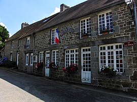
 The town hall in Dompierre | |
| Coordinates: 48°37′59″N 0°33′03″W / 48.6331°N 0.5508°W | |
| Country | France |
| Region | Normandy |
| Department | Orne |
| Arrondissement | Argentan |
| Canton | La Ferté-Macé |
| Intercommunality | CA Flers Agglo |
| Government | |
| • Mayor (2020–2026) | Daniel Bigeon [1] |
| Area 1 | 8.56 km2 (3.31 sq mi) |
| Population (2021)
[2] | 392 |
| • Density | 46/km2 (120/sq mi) |
| Time zone | UTC+01:00 ( CET) |
| • Summer ( DST) | UTC+02:00 ( CEST) |
| INSEE/Postal code |
61146 /61700 |
| Elevation | 172–257 m (564–843 ft) (avg. 220 m or 720 ft) |
| 1 French Land Register data, which excludes lakes, ponds, glaciers > 1 km2 (0.386 sq mi or 247 acres) and river estuaries. | |
Dompierre (French pronunciation: [dɔ̃pjɛʁ] ) is a commune in the Orne department in north-western France.
The commune is made up of the following collection of villages and hamlets, Le Château, Le Chemin, Plessis and Dompierre. [3]
It is 860 hectares (3.3 sq mi) in size. The highest point in the commune is 225 metres (738 ft).
The commune is within the Normandie-Maine Regional Natural Park. [4]
The Varenne river is the only watercourse running through this commune.
The Iron House is a museum about the history of the forges and iron mines of Bocage Ornais. [5]
- Sébastien de Brossard (1655-1730), a music theorist, composer and collector, was born here. [6]
- ^ "Répertoire national des élus: les maires". data.gouv.fr, Plateforme ouverte des données publiques françaises (in French). 2 December 2020.
- ^ "Populations légales 2021" (in French). The National Institute of Statistics and Economic Studies. 28 December 2023.
- ^ a b "Dompierre · 61700, France". Dompierre · 61700, France.
- ^ "rapport de charte" (PDF), parc-naturel-normandie-maine.fr/
- ^ "Première saison à la Maison du fer à Dompierre". Ouest-France.fr. 2 May 2012.
- ^ Arnold, Denis; Cochrane, Lalage (1 January 2011). The Oxford Companion to Music. Oxford University Press. doi: 10.1093/acref/9780199579037.001.0001. ISBN 978-0-19-957903-7 – via www.oxfordreference.com.
Dompierre | |
|---|---|
 The town hall in Dompierre | |
| Coordinates: 48°37′59″N 0°33′03″W / 48.6331°N 0.5508°W | |
| Country | France |
| Region | Normandy |
| Department | Orne |
| Arrondissement | Argentan |
| Canton | La Ferté-Macé |
| Intercommunality | CA Flers Agglo |
| Government | |
| • Mayor (2020–2026) | Daniel Bigeon [1] |
| Area 1 | 8.56 km2 (3.31 sq mi) |
| Population (2021)
[2] | 392 |
| • Density | 46/km2 (120/sq mi) |
| Time zone | UTC+01:00 ( CET) |
| • Summer ( DST) | UTC+02:00 ( CEST) |
| INSEE/Postal code |
61146 /61700 |
| Elevation | 172–257 m (564–843 ft) (avg. 220 m or 720 ft) |
| 1 French Land Register data, which excludes lakes, ponds, glaciers > 1 km2 (0.386 sq mi or 247 acres) and river estuaries. | |
Dompierre (French pronunciation: [dɔ̃pjɛʁ] ) is a commune in the Orne department in north-western France.
The commune is made up of the following collection of villages and hamlets, Le Château, Le Chemin, Plessis and Dompierre. [3]
It is 860 hectares (3.3 sq mi) in size. The highest point in the commune is 225 metres (738 ft).
The commune is within the Normandie-Maine Regional Natural Park. [4]
The Varenne river is the only watercourse running through this commune.
The Iron House is a museum about the history of the forges and iron mines of Bocage Ornais. [5]
- Sébastien de Brossard (1655-1730), a music theorist, composer and collector, was born here. [6]
- ^ "Répertoire national des élus: les maires". data.gouv.fr, Plateforme ouverte des données publiques françaises (in French). 2 December 2020.
- ^ "Populations légales 2021" (in French). The National Institute of Statistics and Economic Studies. 28 December 2023.
- ^ a b "Dompierre · 61700, France". Dompierre · 61700, France.
- ^ "rapport de charte" (PDF), parc-naturel-normandie-maine.fr/
- ^ "Première saison à la Maison du fer à Dompierre". Ouest-France.fr. 2 May 2012.
- ^ Arnold, Denis; Cochrane, Lalage (1 January 2011). The Oxford Companion to Music. Oxford University Press. doi: 10.1093/acref/9780199579037.001.0001. ISBN 978-0-19-957903-7 – via www.oxfordreference.com.

