39°44′11″N 45°20′44″E / 39.73639°N 45.34556°E
Agarakadzor
Ագարակաձոր | |
|---|---|
 13th-century bridge near Agarakadzor | |
 Agarakadzor  Agarakadzor | |
| Coordinates: 39°44′11″N 45°20′44″E / 39.73639°N 45.34556°E | |
| Country | Armenia |
| Province | Vayots Dzor |
| Municipality | Areni |
| Population | |
| • Total | 1,301 |
| Time zone | UTC+4 ( AMT) |
| Agarakadzor at GEOnet Names Server | |
Agarakadzor ( Armenian: Ագարակաձոր) is a village in the Areni Municipality of the Vayots Dzor Province in Armenia. Two kilometers from the village is a 13th-century bridge that once served as the main route to Julfa, two kilometers to the east is a 13-15th century cemetery.
The village was previously known as Ayar.
-
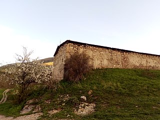 Church in nearby abandoned village of Gandzak
 -
 Nearby abandoned village of Gandzak
 -
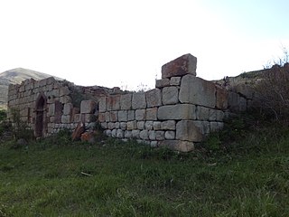 Tukh Manuk Church in nearby abandoned village of Boloraberd
 -
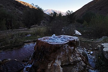 Grav spring in Agarakadzor


- Report of the results of the 2001 Armenian Census, Statistical Committee of Armenia
- Kiesling, Brady (2005), Rediscovering Armenia: Guide, Yerevan, Armenia: Matit Graphic Design Studio
- Kiesling, Brady (June 2000). Rediscovering Armenia: An Archaeological/Touristic Gazetteer and Map Set for the Historical Monuments of Armenia (PDF). Archived (PDF) from the original on 6 November 2021.
Capital:
Yeghegnadzor | ||
| Urban settlements |  | |
| Areni Municipality | ||
| Jermuk Municipality | ||
| Vayk Municipality | ||
| Yeghegis Municipality | ||
| Yeghegnadzor Municipality | ||
|
| This article about a location in Vayots Dzor Province, Armenia is a stub. You can help Wikipedia by expanding it. |
39°44′11″N 45°20′44″E / 39.73639°N 45.34556°E
Agarakadzor
Ագարակաձոր | |
|---|---|
|
13th-century bridge near Agarakadzor | |
Agarakadzor Agarakadzor | |
| Coordinates: 39°44′11″N 45°20′44″E / 39.73639°N 45.34556°E | |
| Country | Armenia |
| Province | Vayots Dzor |
| Municipality | Areni |
| Population | |
| • Total | 1,301 |
| Time zone | UTC+4 ( AMT) |
| Agarakadzor at GEOnet Names Server | |
Agarakadzor ( Armenian: Ագարակաձոր) is a village in the Areni Municipality of the Vayots Dzor Province in Armenia. Two kilometers from the village is a 13th-century bridge that once served as the main route to Julfa, two kilometers to the east is a 13-15th century cemetery.
The village was previously known as Ayar.
-
Church in nearby abandoned village of Gandzak
-
Nearby abandoned village of Gandzak
-
Tukh Manuk Church in nearby abandoned village of Boloraberd
-
Grav spring in Agarakadzor
- Report of the results of the 2001 Armenian Census, Statistical Committee of Armenia
- Kiesling, Brady (2005), Rediscovering Armenia: Guide, Yerevan, Armenia: Matit Graphic Design Studio
- Kiesling, Brady (June 2000). Rediscovering Armenia: An Archaeological/Touristic Gazetteer and Map Set for the Historical Monuments of Armenia (PDF). Archived (PDF) from the original on 6 November 2021.
Capital:
Yeghegnadzor | ||
| Urban settlements | | |
| Areni Municipality | ||
| Jermuk Municipality | ||
| Vayk Municipality | ||
| Yeghegis Municipality | ||
| Yeghegnadzor Municipality | ||
|
| This article about a location in Vayots Dzor Province, Armenia is a stub. You can help Wikipedia by expanding it. |