Telečka
| |
|---|---|
 The Saint Mary Catholic Church. | |
| Coordinates: 45°48′N 19°23′E / 45.800°N 19.383°E | |
| Country | |
| Province | |
| Region | Bačka |
| District | West Bačka |
| Municipality | Sombor |
| Population (2002) | |
| • Total | 2,084 |
| Time zone | UTC+1 ( CET) |
| • Summer ( DST) | UTC+2 ( CEST) |
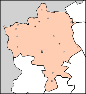
Telečka ( Serbian Cyrillic: Телечка, Hungarian: Bácsgyulafalva) is a village in Serbia. It is in the Sombor municipality, in the West Bačka District, Vojvodina province. The village has a Hungarian ethnic majority and its population is 2,084 people (2002 census). It is surrounded by a sandy region, also referred to as Telečka, or Telečka sands.
History
Settlement was built in 1883-1884 by Hungarian colonists. First census was conducted in 1890 and it recorded population of 2,479 inhabitants. Before the First World War this village was part of Bács-Bodrog County (Kingdom of Hungary, Austria-Hungary). Since 1918, it is part of the Kingdom of Serbs, Croats and Slovenes (later renamed to Yugoslavia). Today, the village has a Hungarian ethnic majority with more than 70% of the population.
Ethnic groups (2002 census)
- Hungarians = 1,508 (72.36%)
- Serbs = 429 (20.59%)
- Romani = 37 (1.78%)
- Yugoslavs = 23 (1.10%)
- Croats = 13 (0.62%)
- others.
Historical population

- 1961: 2,996
- 1971: 2,665
- 1981: 2,429
- 1991: 2,138
See also
References
- Slobodan Ćurčić, Broj stanovnika Vojvodine, Novi Sad, 1996.
External links
45°48′N 19°23′E / 45.800°N 19.383°E
Telečka
| |
|---|---|
 The Saint Mary Catholic Church. | |
| Coordinates: 45°48′N 19°23′E / 45.800°N 19.383°E | |
| Country | |
| Province | |
| Region | Bačka |
| District | West Bačka |
| Municipality | Sombor |
| Population (2002) | |
| • Total | 2,084 |
| Time zone | UTC+1 ( CET) |
| • Summer ( DST) | UTC+2 ( CEST) |
Telečka ( Serbian Cyrillic: Телечка, Hungarian: Bácsgyulafalva) is a village in Serbia. It is in the Sombor municipality, in the West Bačka District, Vojvodina province. The village has a Hungarian ethnic majority and its population is 2,084 people (2002 census). It is surrounded by a sandy region, also referred to as Telečka, or Telečka sands.
History
Settlement was built in 1883-1884 by Hungarian colonists. First census was conducted in 1890 and it recorded population of 2,479 inhabitants. Before the First World War this village was part of Bács-Bodrog County (Kingdom of Hungary, Austria-Hungary). Since 1918, it is part of the Kingdom of Serbs, Croats and Slovenes (later renamed to Yugoslavia). Today, the village has a Hungarian ethnic majority with more than 70% of the population.
Ethnic groups (2002 census)
- Hungarians = 1,508 (72.36%)
- Serbs = 429 (20.59%)
- Romani = 37 (1.78%)
- Yugoslavs = 23 (1.10%)
- Croats = 13 (0.62%)
- others.
Historical population

- 1961: 2,996
- 1971: 2,665
- 1981: 2,429
- 1991: 2,138
See also
References
- Slobodan Ćurčić, Broj stanovnika Vojvodine, Novi Sad, 1996.
External links
45°48′N 19°23′E / 45.800°N 19.383°E


