Rastina
Растина (
Serbian) | |
|---|---|
 The new Orthodox church. | |
| Coordinates: 45°57′33.84″N 19°2′8.16″E / 45.9594000°N 19.0356000°E | |
| Country | |
| Province | |
| Region | Bačka |
| District | West Bačka |
| Municipality | Sombor |
| Population (2011) | |
| • Total | 410 |
| Time zone | UTC+1 ( CET) |
| • Summer ( DST) | UTC+2 ( CEST) |
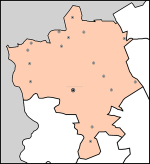
Rastina ( Serbian Cyrillic: Растина) is a village located in the Sombor municipality, in the West Bačka District, Vojvodina province in northern Serbia, at the border with Hungary. The village has a Serb ethnic majority and a population of 410 people (2011 census).
Name
In Serbian, the village is known as Rastina (Растина), in Croatian as Rastina, and in Hungarian as Haraszti or Rasztina.
History
It was first mentioned in the 14th century as Harasti during the administration of the Kingdom of Hungary. During Ottoman rule (16th-17th century), Rastina was populated by ethnic Serbs. In the first half of the 19th century, it was a possession of Baron Redl. In the second half of the 19th century, Rastina was not regarded as separate settlement, but as part of Stanišić, while until the end of the Second World War, it was regarded as part of Riđica. It was officially proclaimed a separate settlement after World War II. After World War I, Rastina was settled by volunteers from Lika and Herzegovina.
Demographics
Historical population
Population of the village in history: [1] [2] [3]
- 1948: 905
- 1953: 939
- 1961: 960
- 1971: 892
- 1981: 686
- 1991: 605
- 2002: 566
- 2011: 410[ citation needed]
Ethnic groups (2002)
- Serbs: 543 (95,93%)
- Others: 23
See also
References
- ^ Књига 1, Становништво, национална или етничка припадност, подаци по насељима, [Serbian Institute of Statistics], Belgrade, February 2003, ISBN 86-84433-00-9
- ^ Књига 2, Становништво, пол и старост, подаци по насељима, Serbian Institute of Statistics, Belgrade, February 2003, ISBN 86-84433-01-7
- ^ Књига 9, Становништво, упоредни преглед броја становника 1948, 1953, 1961, 1971, 1981, 1991, 2002, подаци по насељима, Serbian Institute of Statistics, Belgrade, May 2004, ISBN 86-84433-14-9
- Slobodan Ćurčić (1996). Broj stanovnika Vojvodine (in Serbian). Novi Sad.
{{
cite book}}
: CS1 maint: location missing publisher ( link)
External links
Rastina
Растина (
Serbian) | |
|---|---|
 The new Orthodox church. | |
| Coordinates: 45°57′33.84″N 19°2′8.16″E / 45.9594000°N 19.0356000°E | |
| Country | |
| Province | |
| Region | Bačka |
| District | West Bačka |
| Municipality | Sombor |
| Population (2011) | |
| • Total | 410 |
| Time zone | UTC+1 ( CET) |
| • Summer ( DST) | UTC+2 ( CEST) |
Rastina ( Serbian Cyrillic: Растина) is a village located in the Sombor municipality, in the West Bačka District, Vojvodina province in northern Serbia, at the border with Hungary. The village has a Serb ethnic majority and a population of 410 people (2011 census).
Name
In Serbian, the village is known as Rastina (Растина), in Croatian as Rastina, and in Hungarian as Haraszti or Rasztina.
History
It was first mentioned in the 14th century as Harasti during the administration of the Kingdom of Hungary. During Ottoman rule (16th-17th century), Rastina was populated by ethnic Serbs. In the first half of the 19th century, it was a possession of Baron Redl. In the second half of the 19th century, Rastina was not regarded as separate settlement, but as part of Stanišić, while until the end of the Second World War, it was regarded as part of Riđica. It was officially proclaimed a separate settlement after World War II. After World War I, Rastina was settled by volunteers from Lika and Herzegovina.
Demographics
Historical population
Population of the village in history: [1] [2] [3]
- 1948: 905
- 1953: 939
- 1961: 960
- 1971: 892
- 1981: 686
- 1991: 605
- 2002: 566
- 2011: 410[ citation needed]
Ethnic groups (2002)
- Serbs: 543 (95,93%)
- Others: 23
See also
References
- ^ Књига 1, Становништво, национална или етничка припадност, подаци по насељима, [Serbian Institute of Statistics], Belgrade, February 2003, ISBN 86-84433-00-9
- ^ Књига 2, Становништво, пол и старост, подаци по насељима, Serbian Institute of Statistics, Belgrade, February 2003, ISBN 86-84433-01-7
- ^ Књига 9, Становништво, упоредни преглед броја становника 1948, 1953, 1961, 1971, 1981, 1991, 2002, подаци по насељима, Serbian Institute of Statistics, Belgrade, May 2004, ISBN 86-84433-14-9
- Slobodan Ćurčić (1996). Broj stanovnika Vojvodine (in Serbian). Novi Sad.
{{
cite book}}
: CS1 maint: location missing publisher ( link)


