|
| This article is rated Start-class on Wikipedia's
content assessment scale. It is of interest to the following WikiProjects: | ||||||||||||||||||||||||||
| |||||||||||||||||||||||||||


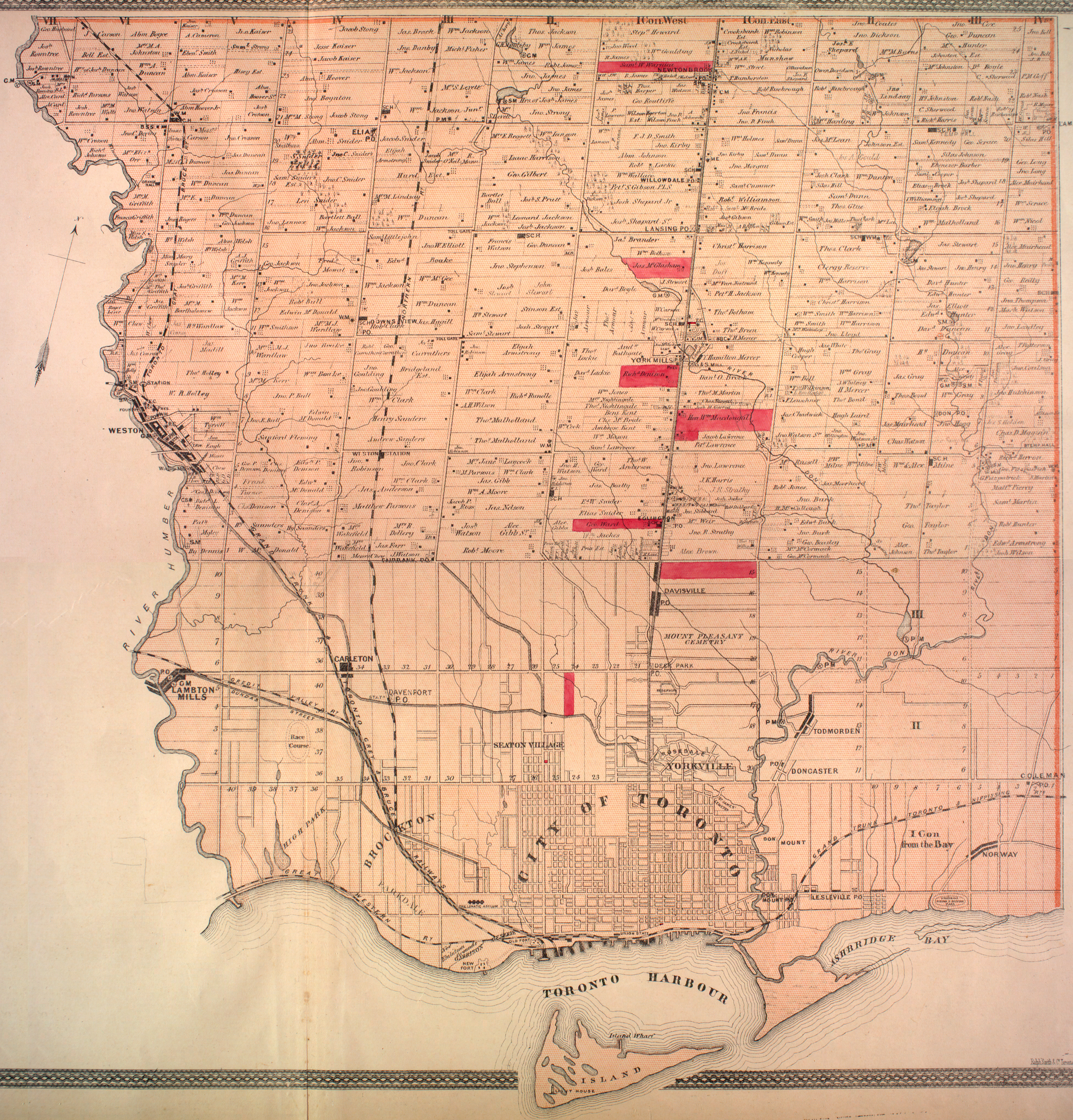
In central Toronto, I believe Finch to have been a "sideroad" and not a concession road. South of Eglinton concession roads ran E-W. North of Eglinton is on a different survey, and concessions run in a S-N direction. Looking at the 1878 map, you can see the concession numbers clearly. Finch is the sideroad between lots 20 and 21 York Township. https://digital.library.mcgill.ca/countyatlas/Images/Maps/TownshipMaps/yor-m-york-n.jpg Feldercarb ( talk) 03:34, 28 January 2018 (UTC)
- Start-Class Canadian street articles
- Low-importance Canadian street articles
- WikiProject Canada Streets articles
- Start-Class Canada-related articles
- Low-importance Canada-related articles
- Start-Class Ontario articles
- Low-importance Ontario articles
- Start-Class Toronto articles
- Low-importance Toronto articles
- All WikiProject Canada pages
|
| This article is rated Start-class on Wikipedia's
content assessment scale. It is of interest to the following WikiProjects: | ||||||||||||||||||||||||||
| |||||||||||||||||||||||||||
In central Toronto, I believe Finch to have been a "sideroad" and not a concession road. South of Eglinton concession roads ran E-W. North of Eglinton is on a different survey, and concessions run in a S-N direction. Looking at the 1878 map, you can see the concession numbers clearly. Finch is the sideroad between lots 20 and 21 York Township. https://digital.library.mcgill.ca/countyatlas/Images/Maps/TownshipMaps/yor-m-york-n.jpg Feldercarb ( talk) 03:34, 28 January 2018 (UTC)
- Start-Class Canadian street articles
- Low-importance Canadian street articles
- WikiProject Canada Streets articles
- Start-Class Canada-related articles
- Low-importance Canada-related articles
- Start-Class Ontario articles
- Low-importance Ontario articles
- Start-Class Toronto articles
- Low-importance Toronto articles
- All WikiProject Canada pages