Photos • Location

Slat | |
|---|---|
 Slat Location within the state of Kentucky  Slat Slat (the United States) | |
| Coordinates: 36°48′36″N 84°54′33″W / 36.81000°N 84.90917°W | |
| Country | United States |
| State | Kentucky |
| County | Wayne |
| Elevation | 1,040 ft (320 m) |
| Time zone | UTC-5 ( Eastern (EST)) |
| • Summer ( DST) | UTC-4 (EST) |
| GNIS feature ID | 509074 [1] |
Slat is an unincorporated community in Wayne County, Kentucky, United States. Its post office [2] is closed.
The origin of the name "Slat" is obscure. [3]
- ^ U.S. Geological Survey Geographic Names Information System: Slat, Kentucky
- ^ U.S. Geological Survey Geographic Names Information System: Slat KY post office
- ^ Moyer, Armond; Moyer, Winifred (1958). The origins of unusual place-names. Keystone Pub. Associates. pp. 141–143.
Municipalities and communities of
Wayne County, Kentucky, United States | ||
|---|---|---|
| City | 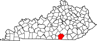 | |
|
Unincorporated communities | ||
| Ghost town | ||
|
| This Wayne County, Kentucky state location article is a stub. You can help Wikipedia by expanding it. |
Slat | |
|---|---|
Slat Location within the state of Kentucky Slat Slat (the United States) | |
| Coordinates: 36°48′36″N 84°54′33″W / 36.81000°N 84.90917°W | |
| Country | United States |
| State | Kentucky |
| County | Wayne |
| Elevation | 1,040 ft (320 m) |
| Time zone | UTC-5 ( Eastern (EST)) |
| • Summer ( DST) | UTC-4 (EST) |
| GNIS feature ID | 509074 [1] |
Slat is an unincorporated community in Wayne County, Kentucky, United States. Its post office [2] is closed.
The origin of the name "Slat" is obscure. [3]
- ^ U.S. Geological Survey Geographic Names Information System: Slat, Kentucky
- ^ U.S. Geological Survey Geographic Names Information System: Slat KY post office
- ^ Moyer, Armond; Moyer, Winifred (1958). The origins of unusual place-names. Keystone Pub. Associates. pp. 141–143.
Municipalities and communities of
Wayne County, Kentucky, United States | ||
|---|---|---|
| City | | |
|
Unincorporated communities | ||
| Ghost town | ||
|
| This Wayne County, Kentucky state location article is a stub. You can help Wikipedia by expanding it. |