Sheridan, Texas | |
|---|---|
 Sheridan Location within the state of Texas  Sheridan Sheridan (the United States) | |
| Coordinates: 29°17′37″N 96°24′6″W / 29.29361°N 96.40167°W | |
| Country | United States |
| State | Texas |
| County | Colorado |
| Time zone | UTC-6 ( Central (CST)) |
| • Summer ( DST) | UTC-5 (CDT) |
Sheridan is an unincorporated community and census designated place in Colorado County, Texas, United States.
Sheridan, TX (Colorado County) By: Jeff Carroll
SHERIDAN, TX (COLORADO COUNTY).Sheridan is on U.S. Highway 90-A and the Middle and West forks of Sandy Creek, near the southwestern boundary of Colorado County. Although it was developed as a farming community, it now derives most of its income from cattle ranching and from the Sheridan oil and gas field. The town dates from 1908, when Hugh Sheridan, from whom the town got its name, sold extensive acreage to the San Antonio Loan and Securities Company. The company, in turn, entered into an agreement with the San Antonio and Aransas Pass Railway to develop the town and promote the sale of lots and small farms. In September 1908 a post office was established with Mrs. Lea A. Scott as postmistress. The plat of the town was recorded in the Colorado county clerk's office in 1909, and on March 6 of that year a hotel was completed to accommodate prospective buyers. Sheridan was widely advertised in the Midwest, and the town grew and prospered. The foremost crop at the time was figs, and the Sheridan Fig Preserving Company shipped crates by rail throughout the United States. Other popular crops included cucumbers, melons, potatoes, and strawberries. The post office moved briefly to nearby Cheetham in 1912 but was returned in a few months to Sheridan, which by 1914 had 150 residents and several businesses. After several false starts the Shell Oil Company brought in a gas-producing discovery well in 1940 in what became the Sheridan oil and gas field. The use of the land for farming declined steeply. Termination of rail service following World War II coincided with the improvement of U.S. Highway 90-A, and the town suffered little in consequence. In 1986 Sheridan had a population of 225 served by seventeen businesses and was noted for its cattle production, its oil and gas field, and the excellent deer hunting in the surrounding area. Through 2000 the population was still recorded at 225.
| Census | Pop. | Note | %± |
|---|---|---|---|
| 2020 | 520 | — | |
| U.S. Decennial Census
[1] 1850–1900 [2] 1910 [3] 1920 [4] 1930 [5] 1940 [6] 1950 [7] 1960 [8] 1970 [9] 1980 [10] 1990 [11] 2000 [12] 2010 [13] | |||
Sheridan first appeared as a census designated place in the 2020 U.S. Census. [14] [13]
| Race / Ethnicity (NH = Non-Hispanic) | Pop 2020 [14] | % 2020 |
|---|---|---|
| White alone (NH) | 342 | 65.77% |
| Black or African American alone (NH) | 7 | 1.35% |
| Native American or Alaska Native alone (NH) | 1 | 0.19% |
| Asian alone (NH) | 3 | 0.58% |
| Pacific Islander alone (NH) | 0 | 0.00% |
| Other race alone (NH) | 1 | 0.19% |
| Mixed race or Multiracial (NH) | 25 | 4.81% |
| Hispanic or Latino (any race) | 141 | 27.12% |
| Total | 520 | 100.00% |
Sheridan is served by the Rice Consolidated Independent School District.
The designated community college for Rice CISD is Wharton County Junior College. [15]
-
 The Sheridan Elementary School is on FM 2437.
 -
 The Splashway Waterpark is on US 90A in Sheridan.
 -
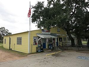 The US Post Office shares a building with a business.


Sheridan is known for many things. Splashway Waterpark and Campground is probably the most well known thing in the town. It is a large waterpark with a campground for RV and Cabin camping. The city is known for many railway systems
- ^ "Decennial Census by Decade". US Census Bureau.
- ^ "1900 Census of Population - Population of Texas By Counties And Minor Civil Divisions" (PDF). United States Census Bureau.
- ^ "1910 Census of Population - Supplement for Texas" (PDF). United States Census Bureau.
- ^ "1920 Census of Population - Number of Inhabitants - Texas" (PDF). United States Census Bureau.
- ^ "1930 Census of Population - Number of Inhabitants - Texas" (PDF). United States Census Bureau.
- ^ "1940 Census of Population - Number of Inhabitants - Texas" (PDF). United States Census Bureau.
- ^ "1950 Census of Population - Number of Inhabitants - Texas" (PDF). United States Census Bureau.
- ^ "1960 Census of Population - Number of Inhabitants - Texas" (PDF). United States Census Bureau.
- ^ "1970 Census of Population - Number of Inhabitants - Texas" (PDF). United States Census Bureau.
- ^ "1980 Census of Population - Number of Inhabitants - Texas" (PDF). United States Census Bureau.
- ^ "1990 Census of Population - Population and Housing Unit Counts - Texas" (PDF). United States Census Bureau.
- ^ "2000 Census of Population - Population and Housing Unit Counts - Texas" (PDF). United States Census Bureau.
- ^ a b "2010 Census of Population - Population and Housing Unit Counts - Texas" (PDF). United States Census Bureau.
- ^ a b "P2: Hispanic or Latino, and Not Hispanic or Latino by Race – 2020: DEC Redistricting Data (PL 94-171) – Sheridan CDP, Texas". United States Census Bureau.
- ^ Texas Education Code Sec. 130.211. WHARTON COUNTY JUNIOR COLLEGE DISTRICT SERVICE AREA.
- Sheridan, Texas from the Handbook of Texas Online
- Colorado County from the Handbook of Texas Online
- Colorado County official website
- U.S. Geological Survey Geographic Names Information System: Sheridan, Texas
Municipalities and communities of
Colorado County, Texas, United States | ||
|---|---|---|
| Cities |  | |
| CDPs | ||
|
Other communities | ||
| Ghost towns | ||
Sheridan, Texas | |
|---|---|
Sheridan Location within the state of Texas Sheridan Sheridan (the United States) | |
| Coordinates: 29°17′37″N 96°24′6″W / 29.29361°N 96.40167°W | |
| Country | United States |
| State | Texas |
| County | Colorado |
| Time zone | UTC-6 ( Central (CST)) |
| • Summer ( DST) | UTC-5 (CDT) |
Sheridan is an unincorporated community and census designated place in Colorado County, Texas, United States.
Sheridan, TX (Colorado County) By: Jeff Carroll
SHERIDAN, TX (COLORADO COUNTY).Sheridan is on U.S. Highway 90-A and the Middle and West forks of Sandy Creek, near the southwestern boundary of Colorado County. Although it was developed as a farming community, it now derives most of its income from cattle ranching and from the Sheridan oil and gas field. The town dates from 1908, when Hugh Sheridan, from whom the town got its name, sold extensive acreage to the San Antonio Loan and Securities Company. The company, in turn, entered into an agreement with the San Antonio and Aransas Pass Railway to develop the town and promote the sale of lots and small farms. In September 1908 a post office was established with Mrs. Lea A. Scott as postmistress. The plat of the town was recorded in the Colorado county clerk's office in 1909, and on March 6 of that year a hotel was completed to accommodate prospective buyers. Sheridan was widely advertised in the Midwest, and the town grew and prospered. The foremost crop at the time was figs, and the Sheridan Fig Preserving Company shipped crates by rail throughout the United States. Other popular crops included cucumbers, melons, potatoes, and strawberries. The post office moved briefly to nearby Cheetham in 1912 but was returned in a few months to Sheridan, which by 1914 had 150 residents and several businesses. After several false starts the Shell Oil Company brought in a gas-producing discovery well in 1940 in what became the Sheridan oil and gas field. The use of the land for farming declined steeply. Termination of rail service following World War II coincided with the improvement of U.S. Highway 90-A, and the town suffered little in consequence. In 1986 Sheridan had a population of 225 served by seventeen businesses and was noted for its cattle production, its oil and gas field, and the excellent deer hunting in the surrounding area. Through 2000 the population was still recorded at 225.
| Census | Pop. | Note | %± |
|---|---|---|---|
| 2020 | 520 | — | |
| U.S. Decennial Census
[1] 1850–1900 [2] 1910 [3] 1920 [4] 1930 [5] 1940 [6] 1950 [7] 1960 [8] 1970 [9] 1980 [10] 1990 [11] 2000 [12] 2010 [13] | |||
Sheridan first appeared as a census designated place in the 2020 U.S. Census. [14] [13]
| Race / Ethnicity (NH = Non-Hispanic) | Pop 2020 [14] | % 2020 |
|---|---|---|
| White alone (NH) | 342 | 65.77% |
| Black or African American alone (NH) | 7 | 1.35% |
| Native American or Alaska Native alone (NH) | 1 | 0.19% |
| Asian alone (NH) | 3 | 0.58% |
| Pacific Islander alone (NH) | 0 | 0.00% |
| Other race alone (NH) | 1 | 0.19% |
| Mixed race or Multiracial (NH) | 25 | 4.81% |
| Hispanic or Latino (any race) | 141 | 27.12% |
| Total | 520 | 100.00% |
Sheridan is served by the Rice Consolidated Independent School District.
The designated community college for Rice CISD is Wharton County Junior College. [15]
-
The Sheridan Elementary School is on FM 2437.
-
The Splashway Waterpark is on US 90A in Sheridan.
-
The US Post Office shares a building with a business.
Sheridan is known for many things. Splashway Waterpark and Campground is probably the most well known thing in the town. It is a large waterpark with a campground for RV and Cabin camping. The city is known for many railway systems
- ^ "Decennial Census by Decade". US Census Bureau.
- ^ "1900 Census of Population - Population of Texas By Counties And Minor Civil Divisions" (PDF). United States Census Bureau.
- ^ "1910 Census of Population - Supplement for Texas" (PDF). United States Census Bureau.
- ^ "1920 Census of Population - Number of Inhabitants - Texas" (PDF). United States Census Bureau.
- ^ "1930 Census of Population - Number of Inhabitants - Texas" (PDF). United States Census Bureau.
- ^ "1940 Census of Population - Number of Inhabitants - Texas" (PDF). United States Census Bureau.
- ^ "1950 Census of Population - Number of Inhabitants - Texas" (PDF). United States Census Bureau.
- ^ "1960 Census of Population - Number of Inhabitants - Texas" (PDF). United States Census Bureau.
- ^ "1970 Census of Population - Number of Inhabitants - Texas" (PDF). United States Census Bureau.
- ^ "1980 Census of Population - Number of Inhabitants - Texas" (PDF). United States Census Bureau.
- ^ "1990 Census of Population - Population and Housing Unit Counts - Texas" (PDF). United States Census Bureau.
- ^ "2000 Census of Population - Population and Housing Unit Counts - Texas" (PDF). United States Census Bureau.
- ^ a b "2010 Census of Population - Population and Housing Unit Counts - Texas" (PDF). United States Census Bureau.
- ^ a b "P2: Hispanic or Latino, and Not Hispanic or Latino by Race – 2020: DEC Redistricting Data (PL 94-171) – Sheridan CDP, Texas". United States Census Bureau.
- ^ Texas Education Code Sec. 130.211. WHARTON COUNTY JUNIOR COLLEGE DISTRICT SERVICE AREA.
- Sheridan, Texas from the Handbook of Texas Online
- Colorado County from the Handbook of Texas Online
- Colorado County official website
- U.S. Geological Survey Geographic Names Information System: Sheridan, Texas
Municipalities and communities of
Colorado County, Texas, United States | ||
|---|---|---|
| Cities | | |
| CDPs | ||
|
Other communities | ||
| Ghost towns | ||