Shelbyville Municipal Airport | |||||||||||||||
|---|---|---|---|---|---|---|---|---|---|---|---|---|---|---|---|
| Summary | |||||||||||||||
| Airport type | Public | ||||||||||||||
| Owner | Shelbyville Board of Aviation Commissioners | ||||||||||||||
| Serves | Shelbyville, Indiana | ||||||||||||||
| Elevation AMSL | 803 ft / 245 m | ||||||||||||||
| Coordinates | 39°34′59″N 085°48′17″W / 39.58306°N 85.80472°W | ||||||||||||||
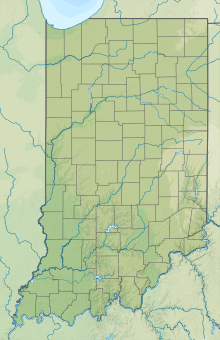
| Map | |||||||||||||||
| Runways | |||||||||||||||
| |||||||||||||||
| Statistics (2006) | |||||||||||||||
| |||||||||||||||
Source:
Federal Aviation Administration
[1] | |||||||||||||||
Shelbyville Municipal Airport ( ICAO: KGEZ, FAA LID: GEZ) is a public use airport located four nautical miles (7 km) northwest of the central business district of Shelbyville, in Shelby County, Indiana, United States. [1] The airport is owned by the city of Shelbyville and is controlled by the mayor and an appointed Board of Commissioners. [2] According to the FAA's National Plan of Integrated Airport Systems for 2009–2013, it was classified as a general aviation airport. [3]
Although most U.S. airports use the same three-letter location identifier for the FAA and IATA, this airport is assigned GEZ by the FAA but has no designation from the IATA. [4]
Facilities and aircraft
Shelbyville Municipal Airport covers an area of 550 acres (220 ha) at an elevation of 803 feet (245 m) above mean sea level. It has two runways: 1/19 is 5,000 by 100 feet (1,524 x 30 m) with an asphalt pavement; 9/27 is 2,671 by 190 feet (814 x 58 m) with a turf surface. [1]
For the 12-month period ending December 31, 2006, the airport had 24,094 aircraft operations, an average of 66 per day: 91% general aviation, 5% military, and 4% air taxi. At that time there were 60 aircraft based at this airport: 88% single- engine, 10% multi-engine, and 2% jet. [1]
Military use
The airport is home of the headquarters of the 38th Combat Aviation Brigade (CAB), 38th Infantry Division, Indiana National Guard. [5]
See also
References
- ^ a b c d FAA Airport Form 5010 for GEZ PDF. Federal Aviation Administration. Effective 17 December 2009.
- ^ Shelbyville Aviation Inc. Accessed 25 January 2010.
- ^ FAA National Plan of Integrated Airport Systems: 2009–2013
- ^ KGEZ – Shelbyville, Indiana – Shelbyville Municipal Airport. Great Circle Mapper. Accessed 25 January 2010.
- ^ "38th Infantry Division - Subordinate Units". Indiana National Guard. Archived from the original on 28 November 2011. Retrieved 5 December 2011.
External links
- Aerial photo as of 27 March 1998 from USGS The National Map via MSR Maps
- FAA Terminal Procedures for GEZ, effective April 18, 2024
- Resources for this airport:
- FAA airport information for GEZ
- AirNav airport information for KGEZ
- FlightAware airport information and live flight tracker
- NOAA/NWS weather observations: current, past three days
- SkyVector aeronautical chart, Terminal Procedures

