Photos • Location
(Redirected from
Sette Cama Airport)
Sette Cama Airport Aéroport de Setté Cama | |||||||||||
|---|---|---|---|---|---|---|---|---|---|---|---|
| Summary | |||||||||||
| Airport type | Public | ||||||||||
| Serves | Sette Cama | ||||||||||
| Elevation AMSL | 10 ft / 3 m | ||||||||||
| Coordinates | 2°32′20″S 9°45′55″E / 2.53889°S 9.76528°E | ||||||||||
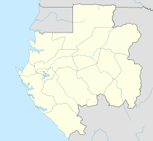
| Map | |||||||||||
| Runways | |||||||||||
| |||||||||||
Sette Cama Airport (French: Aéroport de Setté Cama) ( IATA: ZKM, ICAO: FOOS) is an airstrip serving Sette Cama, in Ogooué-Maritime Province, Gabon. The runway is on a peninsula on the ocean side of the Ndogo Lagoon, 2 kilometres (1.2 mi) southeast of the village.
- ^ Airport information for ZKM at Great Circle Mapper.
- ^ Google Maps - Sette Cama
- ^ Terrains Gabon p. 5 - Sette Cama
