Ryhall & Belmesthorpe | |
|---|---|
 | |
| General information | |
| Location |
Belmesthorpe,
Rutland England |
| Grid reference | TF041102 |
| Platforms | 1 |
| Other information | |
| Status | Disused |
| History | |
| Original company | Stamford & Essendine |
| Pre-grouping | Great Northern Railway |
| Post-grouping |
London and North Eastern Railway Eastern Region of British Railways |
| Key dates | |
| 1 November 1856 | Opened |
| 15 June 1959 | Closed |

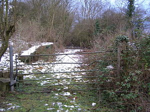
Ryhall & Belmesthorpe railway station (originally Ryhall & Belmisthorpe) was a station in Belmesthorpe and about half a mile from Ryhall, both in Rutland. It was the only intermediate station on the Stamford and Essendine Railway, later Great Northern Railway, single track line between Stamford and Essendine. It was sited south of a level crossing at the west end of the village. The goods yard was to the north of the level crossing. [1] [2]
| Preceding station | Disused railways | Following station | ||
|---|---|---|---|---|
| Great Northern Railway |
References
- ^ .British Railways Atlas.1947. p.17
- ^ "National Monument Record".
52°40′45″N 0°27′42″W / 52.6791°N 0.4617°W
Ryhall & Belmesthorpe | |
|---|---|
 | |
| General information | |
| Location |
Belmesthorpe,
Rutland England |
| Grid reference | TF041102 |
| Platforms | 1 |
| Other information | |
| Status | Disused |
| History | |
| Original company | Stamford & Essendine |
| Pre-grouping | Great Northern Railway |
| Post-grouping |
London and North Eastern Railway Eastern Region of British Railways |
| Key dates | |
| 1 November 1856 | Opened |
| 15 June 1959 | Closed |

Ryhall & Belmesthorpe railway station (originally Ryhall & Belmisthorpe) was a station in Belmesthorpe and about half a mile from Ryhall, both in Rutland. It was the only intermediate station on the Stamford and Essendine Railway, later Great Northern Railway, single track line between Stamford and Essendine. It was sited south of a level crossing at the west end of the village. The goods yard was to the north of the level crossing. [1] [2]
| Preceding station | Disused railways | Following station | ||
|---|---|---|---|---|
| Great Northern Railway |
References
- ^ .British Railways Atlas.1947. p.17
- ^ "National Monument Record".
52°40′45″N 0°27′42″W / 52.6791°N 0.4617°W