Photos • Location
Elmesthorpe | |
|---|---|
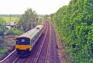
 The site of the station in 1995 | |
| General information | |
| Location | England |
| Coordinates | 52°33′30″N 1°18′33″W / 52.5584°N 1.3092°W |
| Platforms | 2 |
| Other information | |
| Status | Disused |
| History | |
| Original company | South Leicestershire Railway |
| Pre-grouping | London and North Western Railway |
| Post-grouping | London, Midland and Scottish Railway |
| Key dates | |
| 1863 | Opened |
| 4 March 1968 | Closed |
Elmesthorpe was a railway station serving the village of Elmesthorpe in the Blaby district of Leicestershire, England. It was located on what is now the Birmingham to Peterborough Line and was located between Croft and Hinckley. The station was opened in 1863 and closed in 1968. [1] [2]
References
- ^ Site of Elmesthorpe station with train, 1995
- ^ Past Times: A history of Elmesthorpe The Hinckley Times
Elmesthorpe | |
|---|---|
 The site of the station in 1995 | |
| General information | |
| Location | England |
| Coordinates | 52°33′30″N 1°18′33″W / 52.5584°N 1.3092°W |
| Platforms | 2 |
| Other information | |
| Status | Disused |
| History | |
| Original company | South Leicestershire Railway |
| Pre-grouping | London and North Western Railway |
| Post-grouping | London, Midland and Scottish Railway |
| Key dates | |
| 1863 | Opened |
| 4 March 1968 | Closed |
Elmesthorpe was a railway station serving the village of Elmesthorpe in the Blaby district of Leicestershire, England. It was located on what is now the Birmingham to Peterborough Line and was located between Croft and Hinckley. The station was opened in 1863 and closed in 1968. [1] [2]
References
- ^ Site of Elmesthorpe station with train, 1995
- ^ Past Times: A history of Elmesthorpe The Hinckley Times