Photos • Location
Ribeira Alta | |
|---|---|
Settlement | |
| Coordinates: 17°08′35″N 25°11′31″W / 17.143°N 25.192°W | |
| Country | Cape Verde |
| Island | Santo Antão |
| Municipality | Ribeira Grande |
| Civil parish | São Pedro Apóstolo |
| Population (2010)
[1] | |
| • Total | 170 |
| ID | 11405 |
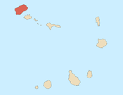
Ribeira Alta is a settlement in the northern part of the island of Santo Antão, Cape Verde. It is situated in a mountain valley near the north coast, 19 km northwest of the island capital Porto Novo.
See also
References
- ^ "2010 Census results". Instituto Nacional de Estatística Cabo Verde (in Portuguese). 24 November 2016.

