Photos • Location
Coculi | |
|---|---|
Settlement | |
 | |
| Coordinates: 17°09′54″N 25°05′53″W / 17.165°N 25.098°W | |
| Country | Cape Verde |
| Island | Santo Antão |
| Municipality | Ribeira Grande |
| Civil parish | Santo Crucifixo |
| Population (2010)
[1] | |
| • Total | 901 |
| ID | 11306 |
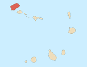
Coculi is a town [2] in the northern part of the island of Santo Antão, Cape Verde. It is situated on the river Ribeira Grande, 4 km southwest of the town Ribeira Grande and 17 km north of the island capital Porto Novo. About 400 meters to its west is the confluence of Ribeira de Chã das Pedras.
See also
References
- ^ "2010 Census results". Instituto Nacional de Estatística Cabo Verde (in Portuguese). 24 November 2016.
- ^ Cabo Verde, Statistical Yearbook 2015, Instituto Nacional de Estatística, p. 32-33
Coculi | |
|---|---|
Settlement | |
 | |
| Coordinates: 17°09′54″N 25°05′53″W / 17.165°N 25.098°W | |
| Country | Cape Verde |
| Island | Santo Antão |
| Municipality | Ribeira Grande |
| Civil parish | Santo Crucifixo |
| Population (2010)
[1] | |
| • Total | 901 |
| ID | 11306 |
Coculi is a town [2] in the northern part of the island of Santo Antão, Cape Verde. It is situated on the river Ribeira Grande, 4 km southwest of the town Ribeira Grande and 17 km north of the island capital Porto Novo. About 400 meters to its west is the confluence of Ribeira de Chã das Pedras.
See also
References
- ^ "2010 Census results". Instituto Nacional de Estatística Cabo Verde (in Portuguese). 24 November 2016.
- ^ Cabo Verde, Statistical Yearbook 2015, Instituto Nacional de Estatística, p. 32-33

