Route 241 | ||||
|---|---|---|---|---|
 | ||||
| Route information | ||||
| Maintained by Transports Québec | ||||
| Length | 54.8 km [1] (34.1 mi) | |||
| Major junctions | ||||
| South end | ||||
| North end | ||||
| Location | ||||
| Country | Canada | |||
| Province | Quebec | |||
| Highway system | ||||
| ||||

Route 241 is a north/south provincial highway on the south shore of the Saint Lawrence River in Quebec. Its northern terminus is in Roxton Falls at the junction of Route 139 and its southern terminus is close to Cowansville, at the junction of Route 139 once again. The highway overlaps both Route 112 and Route 243 in Waterloo located east of Granby and Bromont and just north of Autoroute 10.
Municipalities along Route 241
-
 Routes 112, 241 and 243 meet in front of Saint-Bernardin church in Waterloo.
 -
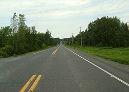 Route 241 in Saint-Joachim-de-Shefford.
 -
 Principale street (main street) in Saint-Joachim.

.jpg)

See also
References
- ^ Ministère des transports, "Distances routières", page 87-88, Les Publications du Québec, 2005
External links
- Route 241 on Google Maps
- Provincial Route Map (Courtesy of the Quebec Ministry of Transportation) (in French)
|
| This Quebec road, road transport or highway-related article is a stub. You can help Wikipedia by expanding it. |
Route 241 | ||||
|---|---|---|---|---|
|
| ||||
| Route information | ||||
| Maintained by Transports Québec | ||||
| Length | 54.8 km [1] (34.1 mi) | |||
| Major junctions | ||||
| South end | ||||
| North end | ||||
| Location | ||||
| Country | Canada | |||
| Province | Quebec | |||
| Highway system | ||||
| ||||
Route 241 is a north/south provincial highway on the south shore of the Saint Lawrence River in Quebec. Its northern terminus is in Roxton Falls at the junction of Route 139 and its southern terminus is close to Cowansville, at the junction of Route 139 once again. The highway overlaps both Route 112 and Route 243 in Waterloo located east of Granby and Bromont and just north of Autoroute 10.
Municipalities along Route 241
-
Routes 112, 241 and 243 meet in front of Saint-Bernardin church in Waterloo.
-
Route 241 in Saint-Joachim-de-Shefford.
-
Principale street (main street) in Saint-Joachim.
See also
References
- ^ Ministère des transports, "Distances routières", page 87-88, Les Publications du Québec, 2005
External links
- Route 241 on Google Maps
- Provincial Route Map (Courtesy of the Quebec Ministry of Transportation) (in French)
|
| This Quebec road, road transport or highway-related article is a stub. You can help Wikipedia by expanding it. |