Route 236 | ||||
|---|---|---|---|---|
 | ||||
| Route information | ||||
| Maintained by Transports Québec | ||||
| Length | 29.4 km [1] (18.3 mi) | |||
| Major junctions | ||||
| West end | ||||
| East end | ||||
| Location | ||||
| Country | Canada | |||
| Province | Quebec | |||
| Highway system | ||||
| ||||

Route 236 is a two-lane east/west highway on the south shore of the Saint Lawrence River in the Montérégie region of Quebec, Canada. Its western terminus is in Saint-Stanislas-de-Kostka at the junction of Route 132 and the eastern terminus is at the junction of Route 132 again, in Beauharnois.
Up until the 1980s, Route 236 also used to extend further west, with an additional stretch between Sainte-Barbe and the hamlet of Cazaville, part of Saint-Anicet.
Municipalities along Route 236
-
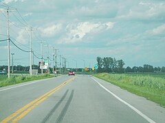 Junction of Routes 236 and 132, near the western end.
 -
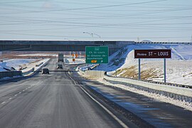 Autoroute 30 interchange with Route 236.
.jpg)
.jpg)
See also
References
- ^ Ministère des transports, "Distances routières", page 87, Les Publications du Québec, 2005
External links
- Official Transport Quebec Road Map (Courtesy of the Quebec Ministry of Transportation)
- Route 236 on Google Maps
45°14′24″N 73°54′43″W / 45.2401°N 73.9119°W
|
| This Quebec road, road transport or highway-related article is a stub. You can help Wikipedia by expanding it. |
Route 236 | ||||
|---|---|---|---|---|
|
| ||||
| Route information | ||||
| Maintained by Transports Québec | ||||
| Length | 29.4 km [1] (18.3 mi) | |||
| Major junctions | ||||
| West end | ||||
| East end | ||||
| Location | ||||
| Country | Canada | |||
| Province | Quebec | |||
| Highway system | ||||
| ||||
Route 236 is a two-lane east/west highway on the south shore of the Saint Lawrence River in the Montérégie region of Quebec, Canada. Its western terminus is in Saint-Stanislas-de-Kostka at the junction of Route 132 and the eastern terminus is at the junction of Route 132 again, in Beauharnois.
Up until the 1980s, Route 236 also used to extend further west, with an additional stretch between Sainte-Barbe and the hamlet of Cazaville, part of Saint-Anicet.
Municipalities along Route 236
-
Junction of Routes 236 and 132, near the western end.
-
Autoroute 30 interchange with Route 236.
See also
References
- ^ Ministère des transports, "Distances routières", page 87, Les Publications du Québec, 2005
External links
- Official Transport Quebec Road Map (Courtesy of the Quebec Ministry of Transportation)
- Route 236 on Google Maps
45°14′24″N 73°54′43″W / 45.2401°N 73.9119°W
|
| This Quebec road, road transport or highway-related article is a stub. You can help Wikipedia by expanding it. |