Photos • Location
Qâa er Rîm
قاع الريم | |
|---|---|
Village | |
 Qâa er Rîm, panorama | |
| Coordinates: 33°53′05″N 35°52′31″E / 33.88472°N 35.87528°E | |
| Country | Lebanon |
| Governorate | Beqaa Governorate |
| District | Zahlé |
| Elevation | 4,100 ft (1,250 m) |
| Time zone | UTC+2 ( EET) |
| • Summer ( DST) | +3 |
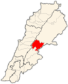
Qâa er Rîm ( Arabic: قاع الريم) (also known as Qā‘ar Rīm) is a populated place in the Beqaa Governorate of Lebanon. [1]
References
External links
- Qaa Er Rim, Localiban
Qâa er Rîm
قاع الريم | |
|---|---|
Village | |
 Qâa er Rîm, panorama | |
| Coordinates: 33°53′05″N 35°52′31″E / 33.88472°N 35.87528°E | |
| Country | Lebanon |
| Governorate | Beqaa Governorate |
| District | Zahlé |
| Elevation | 4,100 ft (1,250 m) |
| Time zone | UTC+2 ( EET) |
| • Summer ( DST) | +3 |
Qâa er Rîm ( Arabic: قاع الريم) (also known as Qā‘ar Rīm) is a populated place in the Beqaa Governorate of Lebanon. [1]
References
External links
- Qaa Er Rim, Localiban

