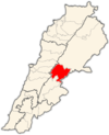
Photos • Location
Ain Kfar Zabad
عين كفر زبد | |
|---|---|
Village | |
| Coordinates: 33°47′45″N 36°00′17″E / 33.795938°N 36.004584°E | |
| Country | |
| Governorate | Beqaa Governorate |
| District | Zahlé |
| Elevation | 3,000 ft (1,000 m) |
| Time zone | UTC+2 ( EET) |
| • Summer ( DST) | +3 |
Ain Kfar Zabad, or Aïn Kafar Zabad ( Arabic: عين كفر زبد) is a village situated 62 km (38.53 mi) to the East of the Lebanese capital Beirut.
The river Bardaouni crosses the village.
External links
- Ain Kfar Zabad, Localiban

