Highway 722 | ||||
|---|---|---|---|---|
| Ruta 722 | ||||
| Route information | ||||
| Maintained by Puerto Rico DTPW | ||||
| Length | 7.7 km [1] (4.8 mi) | |||
| Existed | 1953 [2]–present | |||
| Major junctions | ||||
| CCW end | ||||
| CW end | ||||
| Location | ||||
| Country | United States | |||
| Territory | Puerto Rico | |||
| Municipalities | Aibonito | |||
| Highway system | ||||
| ||||
| ||||

Puerto Rico Highway 722 (PR-722) is a rural road located in Aibonito, Puerto Rico. [3] It begins at its intersection with PR-14 east of downtown Aibonito and ends at the Ruta Panorámica between Robles and Pasto barrios. [4] The traditional Festival de las Flores is celebrated near this road. [5]
- Puerto Rico Highway 722
-
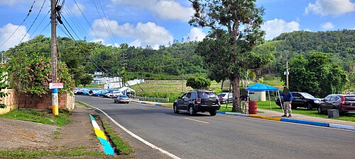 Heading south in Robles barrio
 -
 Detour sign in Aibonito barrio-pueblo
.jpg)
.jpg)
Major intersections
The entire route is located in Aibonito.
| Location | km [1] | mi | Destinations | Notes | |
|---|---|---|---|---|---|
| Pasto– Robles line | 0.0 | 0.0 | Counterclockwise terminus of PR-722; western terminus of the Ruta Panorámica concurrency; the Ruta Panorámica continues toward Barranquitas | ||
| Robles | 2.7 | 1.7 | Eastern terminus of the Ruta Panorámica concurrency; the Ruta Panorámica continues toward Cayey | ||
| Aibonito barrio-pueblo | 7.7 | 4.8 | Clockwise terminus of PR-722 | ||
1.000 mi = 1.609 km; 1.000 km = 0.621 mi
| |||||
Related route
Highway 7722 | |
|---|---|
| Location | Cayey – Aibonito |
| Length | 6.3 km [6] (3.9 mi) |
Puerto Rico Highway 7722 (PR-7722) is a segment of the Ruta Panorámica that travels from Cayey to Aibonito. It begins at PR-1 between Pasto Viejo and Pedro Ávila barrios and ends at PR-722 in Robles. [3]
| Municipality | Location | km [6] | mi | Destinations | Notes |
|---|---|---|---|---|---|
| Aibonito | Robles | 6.3 | 3.9 | Western terminus of PR-7722; the Ruta Panorámica continues toward Barranquitas | |
| Cayey | Pasto Viejo– Pedro Ávila line | 0.0 | 0.0 | Eastern terminus of PR-7722; the Ruta Panorámica continues toward Cayey | |
| 1.000 mi = 1.609 km; 1.000 km = 0.621 mi | |||||
See also
References
- ^ a b Google (29 February 2020). "PR-722" (Map). Google Maps. Google. Retrieved 29 February 2020.
- ^ "Aibonito, Memoria Núm. 43" (PDF). Puerto Rico Planning Board (in Spanish). 1955. Retrieved 3 August 2020.
- ^ a b National Geographic Maps (2011). Puerto Rico (Map). 1:125,000. Adventure Map (Book 3107). Evergreen, Colorado: National Geographic Maps. ISBN 978-1566955188. OCLC 756511572.
- ^ "Tránsito Promedio Diario (AADT)". Puerto Rico Department of Transportation and Public Works (in Spanish). p. 126. Archived from the original on 1 April 2019. Retrieved 22 May 2019.
- ^ "Regresa el Festival de las Flores en Aibonito". Primera Hora (in Spanish). Retrieved 22 May 2019.
- ^ a b Google (29 February 2020). "PR-7722" (Map). Google Maps. Google. Retrieved 29 February 2020.
External links
|
| This Puerto Rico road-related article is a stub. You can help Wikipedia by expanding it. |
Highway 722 | ||||
|---|---|---|---|---|
| Ruta 722 | ||||
| Route information | ||||
| Maintained by Puerto Rico DTPW | ||||
| Length | 7.7 km [1] (4.8 mi) | |||
| Existed | 1953 [2]–present | |||
| Major junctions | ||||
| CCW end | ||||
| CW end | ||||
| Location | ||||
| Country | United States | |||
| Territory | Puerto Rico | |||
| Municipalities | Aibonito | |||
| Highway system | ||||
| ||||
| ||||
Puerto Rico Highway 722 (PR-722) is a rural road located in Aibonito, Puerto Rico. [3] It begins at its intersection with PR-14 east of downtown Aibonito and ends at the Ruta Panorámica between Robles and Pasto barrios. [4] The traditional Festival de las Flores is celebrated near this road. [5]
- Puerto Rico Highway 722
-
Heading south in Robles barrio
-
Detour sign in Aibonito barrio-pueblo
Major intersections
The entire route is located in Aibonito.
| Location | km [1] | mi | Destinations | Notes | |
|---|---|---|---|---|---|
| Pasto– Robles line | 0.0 | 0.0 | Counterclockwise terminus of PR-722; western terminus of the Ruta Panorámica concurrency; the Ruta Panorámica continues toward Barranquitas | ||
| Robles | 2.7 | 1.7 | Eastern terminus of the Ruta Panorámica concurrency; the Ruta Panorámica continues toward Cayey | ||
| Aibonito barrio-pueblo | 7.7 | 4.8 | Clockwise terminus of PR-722 | ||
1.000 mi = 1.609 km; 1.000 km = 0.621 mi
| |||||
Related route
Highway 7722 | |
|---|---|
| Location | Cayey – Aibonito |
| Length | 6.3 km [6] (3.9 mi) |
Puerto Rico Highway 7722 (PR-7722) is a segment of the Ruta Panorámica that travels from Cayey to Aibonito. It begins at PR-1 between Pasto Viejo and Pedro Ávila barrios and ends at PR-722 in Robles. [3]
| Municipality | Location | km [6] | mi | Destinations | Notes |
|---|---|---|---|---|---|
| Aibonito | Robles | 6.3 | 3.9 | Western terminus of PR-7722; the Ruta Panorámica continues toward Barranquitas | |
| Cayey | Pasto Viejo– Pedro Ávila line | 0.0 | 0.0 | Eastern terminus of PR-7722; the Ruta Panorámica continues toward Cayey | |
| 1.000 mi = 1.609 km; 1.000 km = 0.621 mi | |||||
See also
References
- ^ a b Google (29 February 2020). "PR-722" (Map). Google Maps. Google. Retrieved 29 February 2020.
- ^ "Aibonito, Memoria Núm. 43" (PDF). Puerto Rico Planning Board (in Spanish). 1955. Retrieved 3 August 2020.
- ^ a b National Geographic Maps (2011). Puerto Rico (Map). 1:125,000. Adventure Map (Book 3107). Evergreen, Colorado: National Geographic Maps. ISBN 978-1566955188. OCLC 756511572.
- ^ "Tránsito Promedio Diario (AADT)". Puerto Rico Department of Transportation and Public Works (in Spanish). p. 126. Archived from the original on 1 April 2019. Retrieved 22 May 2019.
- ^ "Regresa el Festival de las Flores en Aibonito". Primera Hora (in Spanish). Retrieved 22 May 2019.
- ^ a b Google (29 February 2020). "PR-7722" (Map). Google Maps. Google. Retrieved 29 February 2020.
External links
|
| This Puerto Rico road-related article is a stub. You can help Wikipedia by expanding it. |