You can help expand this article with text translated from
the corresponding article in Estonian. (August 2023) Click [show] for important translation instructions.
|
Pelgulinn | |
|---|---|
Subdistrict of
Tallinn | |
 Preesi Street with typical wooden apartment buildings from the 1930s | |
 Pelgulinn within Põhja-Tallinn | |
| Country | Estonia |
| County | Harju County |
| City | Tallinn |
| District | Põhja-Tallinn |
| Population (1 January 2015
[1]) | |
| • Total | 15,949 |
| Website |
www |
Pelgulinn ( Estonian for 'refuge/hiding town') is a subdistrict (asum) of Põhja-Tallinn (North Tallinn) in Tallinn, the capital of Estonia. It is located about 2 km (1 mi) northwest of the city centre. Pelgulinn borders Kalamaja to the east, Kelmiküla to the southeast, Lilleküla to the south, Merimetsa to the west, Pelguranna to the northwest, and Karjamaa to the north. The subdistrict has a population of 15,949 (as of 1 January 2015 [update]). [1]
In the 18th century, the area was largely covered by meadows and forests. It was used by criminals and outlaws as a hiding place, hence the name Pelgulinn, which refers to a hiding place. Pelgulinn started as a slum inhabited by the workers of Tallinn– Saint Petersburg railway at the end of the 19th century. [2]
Gallery
-
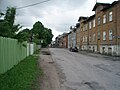
 The oldest part of Pelgulinn, Härjapea Street
 -
 Heina Street near the Kopli freight station
 -
 Kolde puiestee, an avenue leading to Stroomi Beach
 -
 Ristiku Primary School
 -
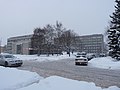
 Police station
 -
 Pelgulinn Maternity Hospital


References
- ^ a b "Statistical Yearbook of Tallinn 2015". Tallinn City Government. p. 38. Archived from the original on 19 November 2015. Retrieved 25 October 2015.
-
^
"Pelgulinna asumi ajaloost" (in Estonian). Tallinn
http://www.tallinn.ee. Retrieved 24 November 2009.
{{
cite web}}
: External link in|publisher=
External links
- Pelgulinna Rahvamaja (Pelgulinn civic house) (in Estonian)
- Pelgulinna Majaomanike Selts (Pelgulinn houseowners' association) (in Estonian)
59°26′28″N 24°42′50″E / 59.441213°N 24.713852°E
Places adjacent to Pelgulinn | |
|---|---|
Administrative districts (linnaosad) and subdistricts (asumid) of
Tallinn | ||
|---|---|---|
| Haabersti |  | |
| Kesklinn | ||
| Kristiine | ||
| Lasnamäe | ||
| Mustamäe | ||
| Nõmme | ||
| Pirita | ||
| Põhja-Tallinn | ||
|
| This Tallinn location article is a stub. You can help Wikipedia by expanding it. |
You can help expand this article with text translated from
the corresponding article in Estonian. (August 2023) Click [show] for important translation instructions.
|
Pelgulinn | |
|---|---|
Subdistrict of
Tallinn | |
|
Preesi Street with typical wooden apartment buildings from the 1930s | |
|
Pelgulinn within Põhja-Tallinn | |
| Country | Estonia |
| County | Harju County |
| City | Tallinn |
| District | Põhja-Tallinn |
| Population (1 January 2015
[1]) | |
| • Total | 15,949 |
| Website |
www |
Pelgulinn ( Estonian for 'refuge/hiding town') is a subdistrict (asum) of Põhja-Tallinn (North Tallinn) in Tallinn, the capital of Estonia. It is located about 2 km (1 mi) northwest of the city centre. Pelgulinn borders Kalamaja to the east, Kelmiküla to the southeast, Lilleküla to the south, Merimetsa to the west, Pelguranna to the northwest, and Karjamaa to the north. The subdistrict has a population of 15,949 (as of 1 January 2015 [update]). [1]
In the 18th century, the area was largely covered by meadows and forests. It was used by criminals and outlaws as a hiding place, hence the name Pelgulinn, which refers to a hiding place. Pelgulinn started as a slum inhabited by the workers of Tallinn– Saint Petersburg railway at the end of the 19th century. [2]
Gallery
-
The oldest part of Pelgulinn, Härjapea Street
-
Heina Street near the Kopli freight station
-
Kolde puiestee, an avenue leading to Stroomi Beach
-
Ristiku Primary School
-
Police station
-
Pelgulinn Maternity Hospital
References
- ^ a b "Statistical Yearbook of Tallinn 2015". Tallinn City Government. p. 38. Archived from the original on 19 November 2015. Retrieved 25 October 2015.
-
^
"Pelgulinna asumi ajaloost" (in Estonian). Tallinn
http://www.tallinn.ee. Retrieved 24 November 2009.
{{
cite web}}
: External link in|publisher=
External links
- Pelgulinna Rahvamaja (Pelgulinn civic house) (in Estonian)
- Pelgulinna Majaomanike Selts (Pelgulinn houseowners' association) (in Estonian)
59°26′28″N 24°42′50″E / 59.441213°N 24.713852°E
Places adjacent to Pelgulinn | |
|---|---|
Administrative districts (linnaosad) and subdistricts (asumid) of
Tallinn | ||
|---|---|---|
| Haabersti | | |
| Kesklinn | ||
| Kristiine | ||
| Lasnamäe | ||
| Mustamäe | ||
| Nõmme | ||
| Pirita | ||
| Põhja-Tallinn | ||
|
| This Tallinn location article is a stub. You can help Wikipedia by expanding it. |