Photos • Location

Parmleysville | |
|---|---|
 Parmleysville Location within the state of Kentucky  Parmleysville Parmleysville (the United States) | |
| Coordinates: 36°41′3″N 84°45′14″W / 36.68417°N 84.75389°W | |
| Country | United States |
| State | Kentucky |
| County | Wayne |
| Elevation | 902 ft (275 m) |
| Time zone | UTC-5 ( Eastern (EST)) |
| • Summer ( DST) | UTC-4 (EST) |
| GNIS feature ID | 514443 [1] |
Parmleysville is an unincorporated community in Wayne County, Kentucky, United States. Also known as Horse Hollow, it lies approximately 14 miles southeast of the county seat of Monticello along the banks of the Little South Fork of the Cumberland River.
Municipalities and communities of
Wayne County, Kentucky, United States | ||
|---|---|---|
| City | 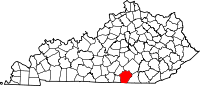 | |
|
Unincorporated communities | ||
| Ghost town | ||
|
| This Wayne County, Kentucky state location article is a stub. You can help Wikipedia by expanding it. |
Parmleysville | |
|---|---|
Parmleysville Location within the state of Kentucky Parmleysville Parmleysville (the United States) | |
| Coordinates: 36°41′3″N 84°45′14″W / 36.68417°N 84.75389°W | |
| Country | United States |
| State | Kentucky |
| County | Wayne |
| Elevation | 902 ft (275 m) |
| Time zone | UTC-5 ( Eastern (EST)) |
| • Summer ( DST) | UTC-4 (EST) |
| GNIS feature ID | 514443 [1] |
Parmleysville is an unincorporated community in Wayne County, Kentucky, United States. Also known as Horse Hollow, it lies approximately 14 miles southeast of the county seat of Monticello along the banks of the Little South Fork of the Cumberland River.
Municipalities and communities of
Wayne County, Kentucky, United States | ||
|---|---|---|
| City | | |
|
Unincorporated communities | ||
| Ghost town | ||
|
| This Wayne County, Kentucky state location article is a stub. You can help Wikipedia by expanding it. |