| Oltedalsvatnet | |
|---|---|
 | |
| Location | Gjesdal, Rogaland |
| Coordinates | 58°48′53″N 6°00′48″E / 58.8146°N 6.0133°E |
| Primary outflows | Oltedalsåna river |
| Basin countries | Norway |
| Max. length | 4 kilometres (2.5 mi) |
| Max. width | 1.5 kilometres (0.93 mi) |
| Surface area | 3.12 km2 (1.20 sq mi) |
| Water volume | 28,800,000 m3 (23,300 acre⋅ft; 37,700,000 cu yd) |
| Shore length1 | 16.61 kilometres (10.32 mi) |
| Surface elevation | 101.5 to 112.5 metres (333 to 369 ft) |
| References | NVE |
| 1 Shore length is not a well-defined measure. | |
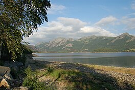
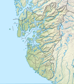
Oltedalsvatnet is a lake in the municipality of Gjesdal in Rogaland county, Norway. [1] The 3.12-square-kilometre (1.20 sq mi) lake lies just south of the village of Oltedal. It is a reservoir along the river Oltedalsåna that is used to store water for the Oltedal Hydroelectric Power Station. The lake sits at an elevation of 101.5 to 112.5 metres (333 to 369 ft) and it holds about 28,800,000 cubic metres (23,300 acre⋅ft; 37,700,000 cu yd). [2]
See also
References
- ^ "Oltedalsvatnet, Gjesdal (Rogaland)" (in Norwegian). yr.no. Retrieved 2016-03-07.
- ^ "Search Oltedalsvatnet > Vannkraft > Magasin > Details" (in Norwegian). NVE Atlas. Archived from the original on 2015-06-26.
| Oltedalsvatnet | |
|---|---|
 | |
| Location | Gjesdal, Rogaland |
| Coordinates | 58°48′53″N 6°00′48″E / 58.8146°N 6.0133°E |
| Primary outflows | Oltedalsåna river |
| Basin countries | Norway |
| Max. length | 4 kilometres (2.5 mi) |
| Max. width | 1.5 kilometres (0.93 mi) |
| Surface area | 3.12 km2 (1.20 sq mi) |
| Water volume | 28,800,000 m3 (23,300 acre⋅ft; 37,700,000 cu yd) |
| Shore length1 | 16.61 kilometres (10.32 mi) |
| Surface elevation | 101.5 to 112.5 metres (333 to 369 ft) |
| References | NVE |
| 1 Shore length is not a well-defined measure. | |
Oltedalsvatnet is a lake in the municipality of Gjesdal in Rogaland county, Norway. [1] The 3.12-square-kilometre (1.20 sq mi) lake lies just south of the village of Oltedal. It is a reservoir along the river Oltedalsåna that is used to store water for the Oltedal Hydroelectric Power Station. The lake sits at an elevation of 101.5 to 112.5 metres (333 to 369 ft) and it holds about 28,800,000 cubic metres (23,300 acre⋅ft; 37,700,000 cu yd). [2]
See also
References
- ^ "Oltedalsvatnet, Gjesdal (Rogaland)" (in Norwegian). yr.no. Retrieved 2016-03-07.
- ^ "Search Oltedalsvatnet > Vannkraft > Magasin > Details" (in Norwegian). NVE Atlas. Archived from the original on 2015-06-26.

