Photos • Location
From Wikipedia, the free encyclopedia
Lake in Norway
| Austrumdalsvatnet | |
|---|---|
 | |
| Location | Bjerkreim, Rogaland |
| Coordinates | 58°41′07″N 6°15′29″E / 58.6854°N 06.2581°E / 58.6854; 06.2581 |
| Type | fjord lake |
| Primary inflows | Stavtjørna and Åni |
| Primary outflows | Austrumdalsåna river |
| Catchment area | 61 km2 (24 sq mi) |
| Basin countries | Norway |
| Max. length | 6 km (3.7 mi) |
| Max. width | 750 m (0.47 mi) |
| Surface area | 2.89 km2 (1.12 sq mi) |
| Average depth | 52.9 m (174 ft) |
| Max. depth | 104 m (341 ft) |
| Water volume | 0.153 km3 (0.037 cu mi) |
| Shore length1 | 13.82 km (8.59 mi) |
| Surface elevation | 309 m (1,014 ft) |
| References | NVE |
| 1 Shore length is not a well-defined measure. | |
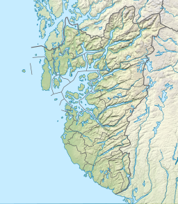
Austrumdalsvatnet is a lake in the municipality of Bjerkreim in Rogaland county, Norway. [1] The 2.89-square-kilometre (1.12 sq mi) lake lies about 2.5 kilometres (1.6 mi) southeast of the lakes Hofreistæ and Byrkjelandsvatnet. The village of Øvrebygd lies about 3 kilometres (1.9 mi) west of the lake.
See also
References
- ^ "Austrumdalsvatnet, Bjerkreim (Rogaland)" (in Norwegian). yr.no. Retrieved 2016-05-01.
Retrieved from "
https://en.wikipedia.org/?title=Austrumdalsvatnet&oldid=1178031663"
Hidden categories:
- Pages using gadget WikiMiniAtlas
- CS1 Norwegian-language sources (no)
- Articles with short description
- Short description matches Wikidata
- Coordinates on Wikidata
- Articles using infobox body of water without alt
- Articles using infobox body of water without pushpin map alt
- Articles using infobox body of water without image bathymetry
- All stub articles
From Wikipedia, the free encyclopedia
Lake in Norway
| Austrumdalsvatnet | |
|---|---|
 | |
| Location | Bjerkreim, Rogaland |
| Coordinates | 58°41′07″N 6°15′29″E / 58.6854°N 06.2581°E / 58.6854; 06.2581 |
| Type | fjord lake |
| Primary inflows | Stavtjørna and Åni |
| Primary outflows | Austrumdalsåna river |
| Catchment area | 61 km2 (24 sq mi) |
| Basin countries | Norway |
| Max. length | 6 km (3.7 mi) |
| Max. width | 750 m (0.47 mi) |
| Surface area | 2.89 km2 (1.12 sq mi) |
| Average depth | 52.9 m (174 ft) |
| Max. depth | 104 m (341 ft) |
| Water volume | 0.153 km3 (0.037 cu mi) |
| Shore length1 | 13.82 km (8.59 mi) |
| Surface elevation | 309 m (1,014 ft) |
| References | NVE |
| 1 Shore length is not a well-defined measure. | |
Austrumdalsvatnet is a lake in the municipality of Bjerkreim in Rogaland county, Norway. [1] The 2.89-square-kilometre (1.12 sq mi) lake lies about 2.5 kilometres (1.6 mi) southeast of the lakes Hofreistæ and Byrkjelandsvatnet. The village of Øvrebygd lies about 3 kilometres (1.9 mi) west of the lake.
See also
References
- ^ "Austrumdalsvatnet, Bjerkreim (Rogaland)" (in Norwegian). yr.no. Retrieved 2016-05-01.
| |||||
| |||||
| |||||
| |||||
| |||||
| |||||
| |||||
| |||||
| |||||
| |||||
| |||||
| |||||
| |||||
| |||||
|
Retrieved from "
https://en.wikipedia.org/?title=Austrumdalsvatnet&oldid=1178031663"
Hidden categories:
- Pages using gadget WikiMiniAtlas
- CS1 Norwegian-language sources (no)
- Articles with short description
- Short description matches Wikidata
- Coordinates on Wikidata
- Articles using infobox body of water without alt
- Articles using infobox body of water without pushpin map alt
- Articles using infobox body of water without image bathymetry
- All stub articles

