Mud Lake | |
|---|---|
 Mud Lake  Mud Lake | |
| Coordinates: 48°19′26″N 95°54′48″W / 48.32389°N 95.91333°W | |
| Country | United States |
| State | Minnesota |
| County | Marshall |
| Elevation | 1,145 ft (349 m) |
| Population (
2010) | |
| • Total | 0 |
| Time zone | UTC-6 ( Central (CST)) |
| • Summer ( DST) | UTC-5 (CDT) |
| GNIS feature ID | 665062 [1] |
Mud Lake is an unorganized territory located in Marshall County, Minnesota, United States. [1] In both the 2000 and 2010 U.S. censuses, the unorganized territory recorded a population of 0.
History
Mud Lake was organized as Mud Lake Township, and named for a former lake that has since been drained. [2]
Geography
According to the United States Census Bureau, the unorganized territory has a total area of 36.0 square miles (93.2 km2), of which 31.3 square miles (81.1 km2) is land and 4.7 square miles (12.1 km2) (13.03%) is water.
Demographics
As of the census [3] of 2000, there were no people living in the unorganized territory.
References
- ^ a b "Unorganized Territory of Mud Lake, Minnesota". Geographic Names Information System. United States Geological Survey, United States Department of the Interior.
- ^ Upham, Warren (1920). Minnesota Geographic Names: Their Origin and Historic Significance. Minnesota Historical Society. p. 329.
- ^ "U.S. Census website". United States Census Bureau. Retrieved 2008-01-31.
Municipalities and communities of
Marshall County, Minnesota, United States | ||
|---|---|---|
| Cities | 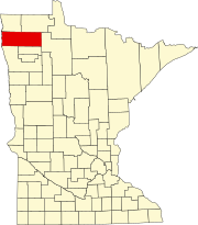 | |
| Townships |
| |
|
Unincorporated communities | ||
|
Unorganized territory | ||
|
Indian reservation | ||
| Footnotes | ‡This populated place also has portions in an adjacent county or counties | |
Mud Lake | |
|---|---|
Mud Lake Mud Lake | |
| Coordinates: 48°19′26″N 95°54′48″W / 48.32389°N 95.91333°W | |
| Country | United States |
| State | Minnesota |
| County | Marshall |
| Elevation | 1,145 ft (349 m) |
| Population (
2010) | |
| • Total | 0 |
| Time zone | UTC-6 ( Central (CST)) |
| • Summer ( DST) | UTC-5 (CDT) |
| GNIS feature ID | 665062 [1] |
Mud Lake is an unorganized territory located in Marshall County, Minnesota, United States. [1] In both the 2000 and 2010 U.S. censuses, the unorganized territory recorded a population of 0.
History
Mud Lake was organized as Mud Lake Township, and named for a former lake that has since been drained. [2]
Geography
According to the United States Census Bureau, the unorganized territory has a total area of 36.0 square miles (93.2 km2), of which 31.3 square miles (81.1 km2) is land and 4.7 square miles (12.1 km2) (13.03%) is water.
Demographics
As of the census [3] of 2000, there were no people living in the unorganized territory.
References
- ^ a b "Unorganized Territory of Mud Lake, Minnesota". Geographic Names Information System. United States Geological Survey, United States Department of the Interior.
- ^ Upham, Warren (1920). Minnesota Geographic Names: Their Origin and Historic Significance. Minnesota Historical Society. p. 329.
- ^ "U.S. Census website". United States Census Bureau. Retrieved 2008-01-31.
Municipalities and communities of
Marshall County, Minnesota, United States | ||
|---|---|---|
| Cities | | |
| Townships |
| |
|
Unincorporated communities | ||
|
Unorganized territory | ||
|
Indian reservation | ||
| Footnotes | ‡This populated place also has portions in an adjacent county or counties | |