| Boyuk Kirs | |
|---|---|
 | |
| Highest point | |
| Elevation | 2,725 m (8,940 ft) |
| Coordinates | 39°38′51″N 46°44′45″E / 39.64750°N 46.74583°E |
| Naming | |
| Native name | Böyük Kirs dağı ( Azerbaijani) |
| Geography | |
 Boyuk Kirs Location of the mountain  Boyuk Kirs Boyuk Kirs (Azerbaijan) | |
| Country | |
Mount Boyuk Kirs ( Azerbaijani: Böyük Kirs dağı — Mount Big Kirs) is one of the highest peaks in the Karabakh Range of the Lesser Caucasus in Azerbaijan at an altitude of 2,725 metres above sea level. [1] Before the 2020 Nagorno-Karabakh War, it was the highest mountain of the breakaway Republic of Arstakh. [2] [3] It forms the border between the Khojavend and Shusha districts of Azerbaijan. The mountain is formed by volcanic rocks dating to the Middle Jurassic. [4]
Toponymy
The mount is named so as to distinguish it from the oronym Kichik Kirs. Kirs is used as a toponymic term meaning "swollen hill, steep mountain". [1]
Geology
The mount is part of the geological Lachyn subzone, which is a narrow Jurassic rock with some Albian- Cenomanian transgressive mantle, over 70 km long, and 2-8 km wide. The subzone is traced from the interfluve of the Pichanis and the Shalva in the northeast, to the left bank of the Araz in the southeast. [5]
Gallery
-
 Mount Boyuk Kirs as seen from the Shusha District during winter.
 -
 Mount Boyuk Kirs as seen from the city of Shusha
 -
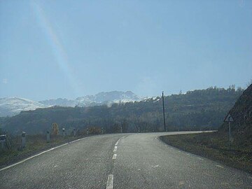 Mount Boyuk Kirs as seen from a road


References
- ^ a b Əliyeva, Rübabə, ed. (2007). AZƏRBAYCAN TOPONİMLƏRİNİN ENSİKLOPEDİK LÜĞƏTİ (PDF) (in Azerbaijani). Vol. 1. Baku: Şərq-Qərb. p. 152. ISBN 978-9952-34-155-3.
- ^ "World atlas". 26 October 2017. Archived from the original on 23 October 2021.
- ^ "Wikiloc". Archived from the original on 23 October 2021.
- ^ "BÖYÜK KİRS". Azərbaycan Milli Ensiklopediyası.
- ^ Geosciences of Azerbaijan. Vol. 1. Springer. 2016. p. 180. ISBN 978-3-319-27393-8.
|
| This Azerbaijan location article is a stub. You can help Wikipedia by expanding it. |
| Boyuk Kirs | |
|---|---|
|
| |
| Highest point | |
| Elevation | 2,725 m (8,940 ft) |
| Coordinates | 39°38′51″N 46°44′45″E / 39.64750°N 46.74583°E |
| Naming | |
| Native name | Böyük Kirs dağı ( Azerbaijani) |
| Geography | |
Boyuk Kirs Location of the mountain Boyuk Kirs Boyuk Kirs (Azerbaijan) | |
| Country | |
Mount Boyuk Kirs ( Azerbaijani: Böyük Kirs dağı — Mount Big Kirs) is one of the highest peaks in the Karabakh Range of the Lesser Caucasus in Azerbaijan at an altitude of 2,725 metres above sea level. [1] Before the 2020 Nagorno-Karabakh War, it was the highest mountain of the breakaway Republic of Arstakh. [2] [3] It forms the border between the Khojavend and Shusha districts of Azerbaijan. The mountain is formed by volcanic rocks dating to the Middle Jurassic. [4]
Toponymy
The mount is named so as to distinguish it from the oronym Kichik Kirs. Kirs is used as a toponymic term meaning "swollen hill, steep mountain". [1]
Geology
The mount is part of the geological Lachyn subzone, which is a narrow Jurassic rock with some Albian- Cenomanian transgressive mantle, over 70 km long, and 2-8 km wide. The subzone is traced from the interfluve of the Pichanis and the Shalva in the northeast, to the left bank of the Araz in the southeast. [5]
Gallery
-
Mount Boyuk Kirs as seen from the Shusha District during winter.
-
Mount Boyuk Kirs as seen from the city of Shusha
-
Mount Boyuk Kirs as seen from a road
References
- ^ a b Əliyeva, Rübabə, ed. (2007). AZƏRBAYCAN TOPONİMLƏRİNİN ENSİKLOPEDİK LÜĞƏTİ (PDF) (in Azerbaijani). Vol. 1. Baku: Şərq-Qərb. p. 152. ISBN 978-9952-34-155-3.
- ^ "World atlas". 26 October 2017. Archived from the original on 23 October 2021.
- ^ "Wikiloc". Archived from the original on 23 October 2021.
- ^ "BÖYÜK KİRS". Azərbaycan Milli Ensiklopediyası.
- ^ Geosciences of Azerbaijan. Vol. 1. Springer. 2016. p. 180. ISBN 978-3-319-27393-8.
|
| This Azerbaijan location article is a stub. You can help Wikipedia by expanding it. |