| Monte Graciosa | |
|---|---|
 Monte Graciosa | |
| Highest point | |
| Elevation | 643 m (2,110 ft) [1] |
| Listing | List of mountains in Cape Verde |
| Coordinates | 15°17′57″N 23°44′56″W / 15.29917°N 23.74889°W |
| Geography | |
northern
Santiago | |
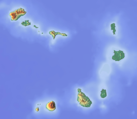
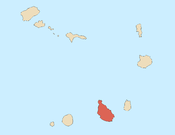
Monte Graciosa ( Portuguese meaning “gracious mountain”) is a mountain in the northern part of the island of Santiago in Cape Verde. It lies 2.5 km north of the town of Tarrafal, overlooking the Baía de Tarrafal. Its elevation is 643 m. [1] Towards the west it ends in the headland of Ponta Preta. It is part of a larger proposed natural park. [2]: 40 The mountain is of volcanic origin, composed of phonolite and rich in feldspar and olivine. [2]: 13
Several endemic plants grow on the mountain, notably Campylanthus glaber ssp. glaber, Euphorbia tuckeyana, Kickxia webbiana (agrião de rocha), Kickxia dichondrifolia, Nauplius daltonii ssp. daltonii, Paronychia illecebroides, Cynanchum daltonii and Macaronesian ironwood ( Sideroxylon marginatum). [2]: 23
-
Plateau near the ocean
-
Monte Graciosa seen from Tarrafal Beach
-
Cynanchum daltonii, an endemic plant of Cape Verde
- ^ a b Tarrafal guia turístico, Câmara municipal do Tarrafal
- ^ a b c Relatório do Plano Director Municipal - Volume I, Câmara Municipal de Tarrafal de Santiago, September 2011
| Monte Graciosa | |
|---|---|
 Monte Graciosa | |
| Highest point | |
| Elevation | 643 m (2,110 ft) [1] |
| Listing | List of mountains in Cape Verde |
| Coordinates | 15°17′57″N 23°44′56″W / 15.29917°N 23.74889°W |
| Geography | |
northern
Santiago | |
Monte Graciosa ( Portuguese meaning “gracious mountain”) is a mountain in the northern part of the island of Santiago in Cape Verde. It lies 2.5 km north of the town of Tarrafal, overlooking the Baía de Tarrafal. Its elevation is 643 m. [1] Towards the west it ends in the headland of Ponta Preta. It is part of a larger proposed natural park. [2]: 40 The mountain is of volcanic origin, composed of phonolite and rich in feldspar and olivine. [2]: 13
Several endemic plants grow on the mountain, notably Campylanthus glaber ssp. glaber, Euphorbia tuckeyana, Kickxia webbiana (agrião de rocha), Kickxia dichondrifolia, Nauplius daltonii ssp. daltonii, Paronychia illecebroides, Cynanchum daltonii and Macaronesian ironwood ( Sideroxylon marginatum). [2]: 23
-
Plateau near the ocean
-
Monte Graciosa seen from Tarrafal Beach
-
Cynanchum daltonii, an endemic plant of Cape Verde
- ^ a b Tarrafal guia turístico, Câmara municipal do Tarrafal
- ^ a b c Relatório do Plano Director Municipal - Volume I, Câmara Municipal de Tarrafal de Santiago, September 2011


