Photos • Location


Martailly-lès-Brancion | |
|---|---|
 The church in Martailly-lès-Brancion | |
.svg) Coat of arms | |
 Martailly-lès-Brancion  Martailly-lès-Brancion | |
| Coordinates: 46°31′59″N 4°48′11″E / 46.5331°N 4.8031°E | |
| Country | France |
| Region | Bourgogne-Franche-Comté |
| Department | Saône-et-Loire |
| Arrondissement | Mâcon |
| Canton | Tournus |
| Area 1 | 8.85 km2 (3.42 sq mi) |
| Population (2021)
[1] | 130 |
| • Density | 15/km2 (38/sq mi) |
| Time zone | UTC+01:00 ( CET) |
| • Summer ( DST) | UTC+02:00 ( CEST) |
| INSEE/Postal code |
71284 /71700 |
| Elevation | 214–476 m (702–1,562 ft) (avg. 250 m or 820 ft) |
| 1 French Land Register data, which excludes lakes, ponds, glaciers > 1 km2 (0.386 sq mi or 247 acres) and river estuaries. | |
Martailly-lès-Brancion (French pronunciation: [maʁtaji lɛ bʁɑ̃sjɔ̃]) is a commune in the Saône-et-Loire department in the region of Bourgogne-Franche-Comté in eastern France.
Gallery
-
 Saint-Peter of Brancion church, built during the 12th century.
 -
 Église Saint-Pierre de Brancion.
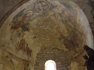
Murals from the Middle Ages in the Saint-Peter of Brancion church. -
 Memorial to the French Resistance and maquis during the Second World War.


See also
References
- ^ "Populations légales 2021" (in French). The National Institute of Statistics and Economic Studies. 28 December 2023.
Wikimedia Commons has media related to
Martailly-lès-Brancion.
| International | |
|---|---|
| National | |
|
| This Saône-et-Loire geographical article is a stub. You can help Wikipedia by expanding it. |
Martailly-lès-Brancion | |
|---|---|
|
The church in Martailly-lès-Brancion | |
|
Coat of arms | |
Martailly-lès-Brancion Martailly-lès-Brancion | |
| Coordinates: 46°31′59″N 4°48′11″E / 46.5331°N 4.8031°E | |
| Country | France |
| Region | Bourgogne-Franche-Comté |
| Department | Saône-et-Loire |
| Arrondissement | Mâcon |
| Canton | Tournus |
| Area 1 | 8.85 km2 (3.42 sq mi) |
| Population (2021)
[1] | 130 |
| • Density | 15/km2 (38/sq mi) |
| Time zone | UTC+01:00 ( CET) |
| • Summer ( DST) | UTC+02:00 ( CEST) |
| INSEE/Postal code |
71284 /71700 |
| Elevation | 214–476 m (702–1,562 ft) (avg. 250 m or 820 ft) |
| 1 French Land Register data, which excludes lakes, ponds, glaciers > 1 km2 (0.386 sq mi or 247 acres) and river estuaries. | |
Martailly-lès-Brancion (French pronunciation: [maʁtaji lɛ bʁɑ̃sjɔ̃]) is a commune in the Saône-et-Loire department in the region of Bourgogne-Franche-Comté in eastern France.
Gallery
-
Saint-Peter of Brancion church, built during the 12th century.
-
Église Saint-Pierre de Brancion.
Murals from the Middle Ages in the Saint-Peter of Brancion church. -
Memorial to the French Resistance and maquis during the Second World War.
See also
References
- ^ "Populations légales 2021" (in French). The National Institute of Statistics and Economic Studies. 28 December 2023.
Wikimedia Commons has media related to
Martailly-lès-Brancion.
| International | |
|---|---|
| National | |
|
| This Saône-et-Loire geographical article is a stub. You can help Wikipedia by expanding it. |