Luxor, Pennsylvania | |
|---|---|
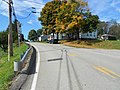
 Intersection of Bovard Luxor Road and Tipple Row Road in Luxor PA | |
 Luxor, Pennsylvania Location within the U.S. state of Pennsylvania | |
| Coordinates: 40°20′3″N 79°28′41″W / 40.33417°N 79.47806°W | |
| Country | United States |
| State | Pennsylvania |
| County | Westmoreland |
| Elevation | 1,089 ft (332 m) |
| Time zone | UTC-5 ( Eastern (EST)) |
| • Summer ( DST) | UTC-4 (EDT) |
| ZIP codes | 15662 |
| GNIS feature ID | 1180092 [1] |
Luxor is an unincorporated community and coal town in Hempfield Township, Westmoreland County, Pennsylvania, United States.
History
The town was established by the Jamison Coal and Coke Company to provide housing for employees of its nearby coal mining complex. Jamison's underground bituminous coal mine, known as Luxor or No. 1 Mine, began operations in the 1890s. Served by the Alexandria branch of the Pennsylvania Railroad, it employed 179 persons by 1897. By 1910 the complex included over 400 coking ovens. In the 1940s the Sekora Coal Company operated a strip mine northeast of the old No. 1 mine. [2] Coal mining in Luxor ended in 1972.
Today
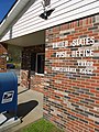
Luxor has its own post office, established in 1894, [3] and zip code (15662). The area covered by this zip code has a population of 271 people. [4] The mining company store, which has been demolished, stood near where the post office is now located. The Luxor Volunteer Fire Department closed in March 2021 due to a lack of membership. [5]
Notable people
- Mike Sebastian - former halfback in the National Football League and second American Football League
- Steve Sundra, former Major League Baseball pitcher and 1939 World Series Champion
Gallery
-
 Houses built for miners
 -
 Remains of coal tipple
 -
 At intersection of Bovard Luxor Road and Tipple Row Road


References
- ^ U.S. Geological Survey Geographic Names Information System: Luxor, Pennsylvania
- ^ "Westmoreland County, Pennsylvania: An Inventory of Historic Engineering and Industrial Sites" (PDF). National Park Service, U.S. Department of the Interior. 1994. Retrieved October 9, 2018.
- ^ "Post Offices by Zip Code". Postmaster Finder. US Postal Service. Retrieved February 4, 2021.
- ^ "ZIP Code 15662". United States Zip Codes. Retrieved October 10, 2018.
- ^ "2 Hempfield fire departments to merge, 1 station to close". January 22, 2021.
See also
Pennsylvania Mine Map Atlas - Pennsylvania State University.

| Counties |
|  | ||||||||
|---|---|---|---|---|---|---|---|---|---|---|
| Major cities | ||||||||||
| Cities and towns 15k–50k (in 2010) | ||||||||||
| Airports | ||||||||||
| Topics | ||||||||||
Luxor, Pennsylvania | |
|---|---|
|
Intersection of Bovard Luxor Road and Tipple Row Road in Luxor PA | |
Luxor, Pennsylvania Location within the U.S. state of Pennsylvania | |
| Coordinates: 40°20′3″N 79°28′41″W / 40.33417°N 79.47806°W | |
| Country | United States |
| State | Pennsylvania |
| County | Westmoreland |
| Elevation | 1,089 ft (332 m) |
| Time zone | UTC-5 ( Eastern (EST)) |
| • Summer ( DST) | UTC-4 (EDT) |
| ZIP codes | 15662 |
| GNIS feature ID | 1180092 [1] |
Luxor is an unincorporated community and coal town in Hempfield Township, Westmoreland County, Pennsylvania, United States.
History
The town was established by the Jamison Coal and Coke Company to provide housing for employees of its nearby coal mining complex. Jamison's underground bituminous coal mine, known as Luxor or No. 1 Mine, began operations in the 1890s. Served by the Alexandria branch of the Pennsylvania Railroad, it employed 179 persons by 1897. By 1910 the complex included over 400 coking ovens. In the 1940s the Sekora Coal Company operated a strip mine northeast of the old No. 1 mine. [2] Coal mining in Luxor ended in 1972.
Today
Luxor has its own post office, established in 1894, [3] and zip code (15662). The area covered by this zip code has a population of 271 people. [4] The mining company store, which has been demolished, stood near where the post office is now located. The Luxor Volunteer Fire Department closed in March 2021 due to a lack of membership. [5]
Notable people
- Mike Sebastian - former halfback in the National Football League and second American Football League
- Steve Sundra, former Major League Baseball pitcher and 1939 World Series Champion
Gallery
-
Houses built for miners
-
Remains of coal tipple
-
At intersection of Bovard Luxor Road and Tipple Row Road
References
- ^ U.S. Geological Survey Geographic Names Information System: Luxor, Pennsylvania
- ^ "Westmoreland County, Pennsylvania: An Inventory of Historic Engineering and Industrial Sites" (PDF). National Park Service, U.S. Department of the Interior. 1994. Retrieved October 9, 2018.
- ^ "Post Offices by Zip Code". Postmaster Finder. US Postal Service. Retrieved February 4, 2021.
- ^ "ZIP Code 15662". United States Zip Codes. Retrieved October 10, 2018.
- ^ "2 Hempfield fire departments to merge, 1 station to close". January 22, 2021.
See also
Pennsylvania Mine Map Atlas - Pennsylvania State University.
| Counties |
| | ||||||||
|---|---|---|---|---|---|---|---|---|---|---|
| Major cities | ||||||||||
| Cities and towns 15k–50k (in 2010) | ||||||||||
| Airports | ||||||||||
| Topics | ||||||||||