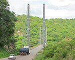
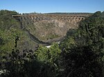
Photos • Location
Historical or architectural interest bridges
| Name | Distinction | Length | Type | Carries Crosses |
Opened | Location | Province | Ref. | ||
|---|---|---|---|---|---|---|---|---|---|---|
| 1 |
Kariba Dam Suspension Bridge dismantled |
Temporary bridge used for the construction of the
Kariba Dam Span : 424 m (1,391 ft) |
219 m (719 ft) |
Suspension Towerless, steel truss deck |
Road bridge Zambezi |
1958 |
Siavonga–
Kariba 16°31′17.5″S 28°45′45.6″E / 16.521528°S 28.762667°E |
Southern Province |
[1] | |
 |
2 | Chinyingi Suspension Bridge | 300 m (980 ft) |
Suspension Steel |
Footbridge Zambezi |
1977 |
Chinyingi 13°21′10.5″S 23°00′44.8″E / 13.352917°S 23.012444°E |
North-Western Province | [2] |
Major bridges
See also
- Transport in Zambia
- Roads in Zambia
- Rail transport in Zambia
- Geography of Zambia
- List of rivers of Zambia
- List of crossings of the Zambezi River
References
- Nicolas Janberg, Structurae.com, International Database for Civil and Structural Engineering
- Others references
- ^ Thompson, F.B. (April 1960). "The road suspension bridge at Kariba". Civil Engineering. 2 (4). South African Institution Of Civil Engineering (SAICE): 57–65. hdl: 10520/AJA10212019_15943. ISSN 1021-2000.
- ^ McIntyre, Chris (2011) [1996]. "Chinyingi Suspension Bridge". In Bradt Travel Guides (ed.). Zambia. p. 507. ISBN 978-1-84162-373-3.
- ^ "History of the Beit Trust". Beittrust.org.uk. Retrieved March 26, 2023.
- ^ "Ponte sospeso "Sir Otto Beit Bridge" (Zambia)" [Suspension bridge "Sir Otto Beit Bridge" (Zambia)]. Isg-progetti.it - ISG-progetti Ingegneria Strutturale e Geotecnica (in Italian). Retrieved March 26, 2023.
- ^ Data collection survey on transport and infrastructure development along Nacala Corridor - final report (PDF). Openjicareport.jica.go.jp (Report). Republic of Zambia - Road Development Agency (RDA) - Japan International Cooperation Agency. March 2019. Retrieved March 19, 2023.
-
^ Yamazaki, Keiji; Kashiwamura, Tomohiko; Otsubo, Masato; Yamazaki, Jun. "Chirundu Bridge Construction Project in Zambia/Zimbabwe".
The Importance of Design and Technical Management in International Bridge (PDF). Archived from
the original (PDF) on 3 January 2020.
{{ cite book}}:|website=ignored ( help) - ^ The Feasibility Study on the Proposed New Bridge Over the Zambezi River at Chirundu Border Post (PDF). Openjicareport.jica.go.jp (Report). Japan International Cooperation Agency. pp. 45–112.
- ^ "Traffic Opens on the Chirundu Bridge Linking Zambia and Zimbabwe". Kajima.co.jp - Kajima Corporation. Kajima News & Notes Vol.24. 2003. Archived from the original on March 3, 2016.
- ^ "Victoria Falls Bridge". Asce.org - American Society of Civil Engineers. Archived from the original on 23 April 2021.
- ^ Roberts, Peter (2011). "Sun, Steel & Spray - A history of the Victoria Falls Bridge". Zambezibookcompany.com. Retrieved 2 December 2022.
- ^ Frémont, Guy; Yi Wu, Ze; Lavigne, Thomas (March 2011). Science et Industrie S.A (ed.). "Le pont multi-haubané de Kazungula sur le Zambèze" [The Kazungula multiple-cable-stayed bridge over the Zambezi] (PDF). Revue Travaux (in French). 879. Fédération nationale des travaux publics (FNTP): 115–121. ISSN 0041-1906.
- ^ "US$259m Kazungula Bridge linking Botswana and Zambia launched". Constructafrica.com. Retrieved March 19, 2023.
- ^ "Zambia: Sioma Bridge: Completed". Ohorongo-cement.com. Retrieved March 26, 2023.
- ^ "President launches K108m Sioma Bridge". Zambia Daily Mail. Retrieved March 26, 2023.
Further reading
- "Bridges of Zimbabwe" (PDF). Rhodesianstudycircle.org.uk. Philatelic Bureau Bulletin N°5. 24 October 2006.
- Cruz, Nuno (May 23, 2017). Ciclo de Conferências: Obras de Engenharia Geotécnica Portuguesa no Mundo – Infraestruturas de transportes [Cycle of Conferences: Works of Portuguese Geotechnical Engineering in the World – transport infrastructure] (PDF). Ordemengenheiros.pt (Report) (in Portuguese). Lisbon: Auditório da Sede Nacional da Ordem dos Engenheiros.
- Prade, Marcel (1990). "Le Zimbabwe". Les Grands Ponts du Monde : Ponts Remarquables Hors d'Europe [The Great Bridges of the World: Remarkable Bridges Outside Europe]. Art et patrimoine (in French). Poitiers: Brissaud. p. 41. ISBN 2-902170-68-8.
External links
- "Brücken in der Sambia" [Bridges in Zambia]. Brueckenweb.de (in German).
- Denenberg, David. "Suspension Bridges of Zambia". Bridgemeister.com.
Historical or architectural interest bridges
| Name | Distinction | Length | Type | Carries Crosses |
Opened | Location | Province | Ref. | ||
|---|---|---|---|---|---|---|---|---|---|---|
| 1 |
Kariba Dam Suspension Bridge dismantled |
Temporary bridge used for the construction of the
Kariba Dam Span : 424 m (1,391 ft) |
219 m (719 ft) |
Suspension Towerless, steel truss deck |
Road bridge Zambezi |
1958 |
Siavonga–
Kariba 16°31′17.5″S 28°45′45.6″E / 16.521528°S 28.762667°E |
Southern Province |
[1] | |
 |
2 | Chinyingi Suspension Bridge | 300 m (980 ft) |
Suspension Steel |
Footbridge Zambezi |
1977 |
Chinyingi 13°21′10.5″S 23°00′44.8″E / 13.352917°S 23.012444°E |
North-Western Province | [2] |
Major bridges
See also
- Transport in Zambia
- Roads in Zambia
- Rail transport in Zambia
- Geography of Zambia
- List of rivers of Zambia
- List of crossings of the Zambezi River
References
- Nicolas Janberg, Structurae.com, International Database for Civil and Structural Engineering
- Others references
- ^ Thompson, F.B. (April 1960). "The road suspension bridge at Kariba". Civil Engineering. 2 (4). South African Institution Of Civil Engineering (SAICE): 57–65. hdl: 10520/AJA10212019_15943. ISSN 1021-2000.
- ^ McIntyre, Chris (2011) [1996]. "Chinyingi Suspension Bridge". In Bradt Travel Guides (ed.). Zambia. p. 507. ISBN 978-1-84162-373-3.
- ^ "History of the Beit Trust". Beittrust.org.uk. Retrieved March 26, 2023.
- ^ "Ponte sospeso "Sir Otto Beit Bridge" (Zambia)" [Suspension bridge "Sir Otto Beit Bridge" (Zambia)]. Isg-progetti.it - ISG-progetti Ingegneria Strutturale e Geotecnica (in Italian). Retrieved March 26, 2023.
- ^ Data collection survey on transport and infrastructure development along Nacala Corridor - final report (PDF). Openjicareport.jica.go.jp (Report). Republic of Zambia - Road Development Agency (RDA) - Japan International Cooperation Agency. March 2019. Retrieved March 19, 2023.
-
^ Yamazaki, Keiji; Kashiwamura, Tomohiko; Otsubo, Masato; Yamazaki, Jun. "Chirundu Bridge Construction Project in Zambia/Zimbabwe".
The Importance of Design and Technical Management in International Bridge (PDF). Archived from
the original (PDF) on 3 January 2020.
{{ cite book}}:|website=ignored ( help) - ^ The Feasibility Study on the Proposed New Bridge Over the Zambezi River at Chirundu Border Post (PDF). Openjicareport.jica.go.jp (Report). Japan International Cooperation Agency. pp. 45–112.
- ^ "Traffic Opens on the Chirundu Bridge Linking Zambia and Zimbabwe". Kajima.co.jp - Kajima Corporation. Kajima News & Notes Vol.24. 2003. Archived from the original on March 3, 2016.
- ^ "Victoria Falls Bridge". Asce.org - American Society of Civil Engineers. Archived from the original on 23 April 2021.
- ^ Roberts, Peter (2011). "Sun, Steel & Spray - A history of the Victoria Falls Bridge". Zambezibookcompany.com. Retrieved 2 December 2022.
- ^ Frémont, Guy; Yi Wu, Ze; Lavigne, Thomas (March 2011). Science et Industrie S.A (ed.). "Le pont multi-haubané de Kazungula sur le Zambèze" [The Kazungula multiple-cable-stayed bridge over the Zambezi] (PDF). Revue Travaux (in French). 879. Fédération nationale des travaux publics (FNTP): 115–121. ISSN 0041-1906.
- ^ "US$259m Kazungula Bridge linking Botswana and Zambia launched". Constructafrica.com. Retrieved March 19, 2023.
- ^ "Zambia: Sioma Bridge: Completed". Ohorongo-cement.com. Retrieved March 26, 2023.
- ^ "President launches K108m Sioma Bridge". Zambia Daily Mail. Retrieved March 26, 2023.
Further reading
- "Bridges of Zimbabwe" (PDF). Rhodesianstudycircle.org.uk. Philatelic Bureau Bulletin N°5. 24 October 2006.
- Cruz, Nuno (May 23, 2017). Ciclo de Conferências: Obras de Engenharia Geotécnica Portuguesa no Mundo – Infraestruturas de transportes [Cycle of Conferences: Works of Portuguese Geotechnical Engineering in the World – transport infrastructure] (PDF). Ordemengenheiros.pt (Report) (in Portuguese). Lisbon: Auditório da Sede Nacional da Ordem dos Engenheiros.
- Prade, Marcel (1990). "Le Zimbabwe". Les Grands Ponts du Monde : Ponts Remarquables Hors d'Europe [The Great Bridges of the World: Remarkable Bridges Outside Europe]. Art et patrimoine (in French). Poitiers: Brissaud. p. 41. ISBN 2-902170-68-8.
External links
- "Brücken in der Sambia" [Bridges in Zambia]. Brueckenweb.de (in German).
- Denenberg, David. "Suspension Bridges of Zambia". Bridgemeister.com.


