Karmir Shuka / Girmizi Bazar
Կարմիր Շուկա / Qırmızı Bazar | |
|---|---|
 | |
 Karmir Shuka / Girmizi Bazar  Karmir Shuka / Girmizi Bazar | |
| Coordinates: 39°40′33″N 46°56′55″E / 39.67583°N 46.94861°E | |
| Country | |
| • District | Khojavend |
| Population (2015)
[1] | |
| • Total | 1,113 |
| Time zone | UTC+4 ( AZT) |
Karmir Shuka ( Armenian: Կարմիր Շուկա) or Girmizi Bazar ( Azerbaijani: Qırmızı Bazar) is a village in the Khojavend District of Azerbaijan, in the disputed region of Nagorno-Karabakh. The village had an Armenian majority in 1989. [2]
Etymology
The name of the village was Krasny Bazar ( Russian: Красный Базар) during the Soviet Union, meaning "Red Market" in Russian. The Armenian name, and the Azerbaijani rendering, also mean "Red Market". [3]
History
During the Soviet period, the village was a part of the Martuni District of the Nagorno-Karabakh Autonomous Oblast.
Historical heritage sites
Historical heritage sites in and around the village include Tnjri, a 2,000-year-old Oriental Plane, the 12th/13th-century village of Mavas ( Armenian: Մավաս), a 12th/13th-century khachkar, a cemetery from between the 17th and 18th centuries, the 17th-century monastic complex of Yerek Mankuk ( Armenian: Երեք մանկուք) in Mavas, the church of Surb Astvatsatsin ( Armenian: Սուրբ Աստվածածին, lit. 'Holy Mother of God') built in 1731 near the nearby village of Skhtorashen, and the 18th-century St. George's Chapel Church ( Armenian: Սուրբ Գևորգ մատուռ-եկեղեցի, romanized: Surb Gevorg Matur-Yekeghetsi). [1] [4]
Economy and culture
The population is mainly engaged in agriculture and animal husbandry. As of 2015, the village has a municipal building, a house of culture, a secondary school, a kindergarten, eight shops, and a medical centre. The community of Karmir Shuka includes the village of Skhtorashen. [1]
Demographics
The village had 926 inhabitants in 2005, [5] and 1,113 inhabitants in 2015. [1]
Gallery
-
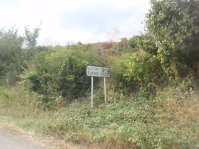 A sign at the entrance of the village on the north–south highway in Nagorno-Karabakh.
 -


References
- ^ a b c d Hakob Ghahramanyan. "Directory of socio-economic characteristics of NKR administrative-territorial units (2015)".
- ^ Андрей Зубов. "Андрей Зубов. Карабах: Мир и Война". drugoivzgliad.com.
- ^ Everett-Heath, John (2020). "Gyrmyzy Bazar". The Concise Dictionary of World Place-Names (6 ed.). Oxford University Press. ISBN 978-0191905636.
- ^ Kiesling, Brady; Kojian, Raffi (2019). Rediscovering Armenia: An in-depth inventory of villages and monuments in Armenia and Artsakh (3rd ed.). Armeniapedia Publishing.
- ^ "The Results of the 2005 Census of the Nagorno-Karabakh Republic" (PDF). National Statistic Service of the Republic of Artsakh.
External links
Capital:
Martuni | ||
| Urban communities |  | |
| Rural communities | ||
| Not under Artsakh control |
| |

Karmir Shuka / Girmizi Bazar
Կարմիր Շուկա / Qırmızı Bazar | |
|---|---|
|
| |
Karmir Shuka / Girmizi Bazar Karmir Shuka / Girmizi Bazar | |
| Coordinates: 39°40′33″N 46°56′55″E / 39.67583°N 46.94861°E | |
| Country | |
| • District | Khojavend |
| Population (2015)
[1] | |
| • Total | 1,113 |
| Time zone | UTC+4 ( AZT) |
Karmir Shuka ( Armenian: Կարմիր Շուկա) or Girmizi Bazar ( Azerbaijani: Qırmızı Bazar) is a village in the Khojavend District of Azerbaijan, in the disputed region of Nagorno-Karabakh. The village had an Armenian majority in 1989. [2]
Etymology
The name of the village was Krasny Bazar ( Russian: Красный Базар) during the Soviet Union, meaning "Red Market" in Russian. The Armenian name, and the Azerbaijani rendering, also mean "Red Market". [3]
History
During the Soviet period, the village was a part of the Martuni District of the Nagorno-Karabakh Autonomous Oblast.
Historical heritage sites
Historical heritage sites in and around the village include Tnjri, a 2,000-year-old Oriental Plane, the 12th/13th-century village of Mavas ( Armenian: Մավաս), a 12th/13th-century khachkar, a cemetery from between the 17th and 18th centuries, the 17th-century monastic complex of Yerek Mankuk ( Armenian: Երեք մանկուք) in Mavas, the church of Surb Astvatsatsin ( Armenian: Սուրբ Աստվածածին, lit. 'Holy Mother of God') built in 1731 near the nearby village of Skhtorashen, and the 18th-century St. George's Chapel Church ( Armenian: Սուրբ Գևորգ մատուռ-եկեղեցի, romanized: Surb Gevorg Matur-Yekeghetsi). [1] [4]
Economy and culture
The population is mainly engaged in agriculture and animal husbandry. As of 2015, the village has a municipal building, a house of culture, a secondary school, a kindergarten, eight shops, and a medical centre. The community of Karmir Shuka includes the village of Skhtorashen. [1]
Demographics
The village had 926 inhabitants in 2005, [5] and 1,113 inhabitants in 2015. [1]
Gallery
-
A sign at the entrance of the village on the north–south highway in Nagorno-Karabakh.
-
References
- ^ a b c d Hakob Ghahramanyan. "Directory of socio-economic characteristics of NKR administrative-territorial units (2015)".
- ^ Андрей Зубов. "Андрей Зубов. Карабах: Мир и Война". drugoivzgliad.com.
- ^ Everett-Heath, John (2020). "Gyrmyzy Bazar". The Concise Dictionary of World Place-Names (6 ed.). Oxford University Press. ISBN 978-0191905636.
- ^ Kiesling, Brady; Kojian, Raffi (2019). Rediscovering Armenia: An in-depth inventory of villages and monuments in Armenia and Artsakh (3rd ed.). Armeniapedia Publishing.
- ^ "The Results of the 2005 Census of the Nagorno-Karabakh Republic" (PDF). National Statistic Service of the Republic of Artsakh.
External links
Capital:
Martuni | ||
| Urban communities | | |
| Rural communities | ||
| Not under Artsakh control |
| |