You can help expand this article with text translated from
the corresponding article in Slovak. Click [show] for important translation instructions.
|
Jastrabie pri Michalovciach | |
|---|---|
Village and
Municipality | |
| Country | |
| Region | Košice |
| District | Michalovce |
| First mentioned | 1337 |
| Government | |
| • Mayor | Milan Kočiško ( Hlas–SD) |
| Area | |
| • Total | 5.74 km2 (2.22 sq mi) |
| Elevation | 104 m (341 ft) |
| Population (2023) | |
| • Total | 289 |
| • Density | 50/km2 (130/sq mi) |
| Area code | +421-56 |

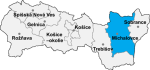
Jastrabie pri Michalovciach (Slovak pronunciation: [ˈjastrabɪe pri ˈmixalɔwtsɪɐx]; Hungarian: Alsókánya) is a village and municipality in Michalovce District in the Kosice Region of eastern Slovakia.
History
In historical records the village was first mentioned in 1337. Before the establishment of independent Czechoslovakia in 1918, it was part of Ung County within the Kingdom of Hungary.
Geography
The village lies at an elevation of 104 metres and covers an area of 5.74 km2 (2.22 sq mi) (2020-06-30/-07-01). [1]
Ethnicity
The population is about 99% Slovak in ethnicity.
Culture
The village has a small public library, a football pitch and a food store.
Notable people
- Steve Ihnat, actor and director
Genealogical resources
The records for genealogical research are available at the state archive "Statny Archiv in Presov, Slovakia"
- Roman Catholic church records (births/marriages/deaths): 1863–1926 (parish B)
- Greek Catholic church records (births/marriages/deaths): 1811–1898 (parish B)
See also
References
- ^ "Statistic of Slovak places by Dušan Kreheľ – Export". Archived from the original on 2021-06-27. Retrieved 2021-07-05.
External links
- https://web.archive.org/web/20070513023228/http://www.statistics.sk/mosmis/eng/run.html
- Surnames of living people in Jastrabie pri Michalovciach
48°42′45″N 22°01′45″E / 48.71250°N 22.02917°E
You can help expand this article with text translated from
the corresponding article in Slovak. Click [show] for important translation instructions.
|
Jastrabie pri Michalovciach | |
|---|---|
Village and
Municipality | |
| Country | |
| Region | Košice |
| District | Michalovce |
| First mentioned | 1337 |
| Government | |
| • Mayor | Milan Kočiško ( Hlas–SD) |
| Area | |
| • Total | 5.74 km2 (2.22 sq mi) |
| Elevation | 104 m (341 ft) |
| Population (2023) | |
| • Total | 289 |
| • Density | 50/km2 (130/sq mi) |
| Area code | +421-56 |

Jastrabie pri Michalovciach (Slovak pronunciation: [ˈjastrabɪe pri ˈmixalɔwtsɪɐx]; Hungarian: Alsókánya) is a village and municipality in Michalovce District in the Kosice Region of eastern Slovakia.
History
In historical records the village was first mentioned in 1337. Before the establishment of independent Czechoslovakia in 1918, it was part of Ung County within the Kingdom of Hungary.
Geography
The village lies at an elevation of 104 metres and covers an area of 5.74 km2 (2.22 sq mi) (2020-06-30/-07-01). [1]
Ethnicity
The population is about 99% Slovak in ethnicity.
Culture
The village has a small public library, a football pitch and a food store.
Notable people
- Steve Ihnat, actor and director
Genealogical resources
The records for genealogical research are available at the state archive "Statny Archiv in Presov, Slovakia"
- Roman Catholic church records (births/marriages/deaths): 1863–1926 (parish B)
- Greek Catholic church records (births/marriages/deaths): 1811–1898 (parish B)
See also
References
- ^ "Statistic of Slovak places by Dušan Kreheľ – Export". Archived from the original on 2021-06-27. Retrieved 2021-07-05.
External links
- https://web.archive.org/web/20070513023228/http://www.statistics.sk/mosmis/eng/run.html
- Surnames of living people in Jastrabie pri Michalovciach
48°42′45″N 22°01′45″E / 48.71250°N 22.02917°E