Photos • Location
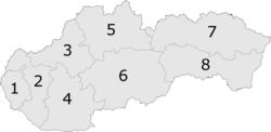
6: Banská Bystrica Region

This article needs additional citations for
verification. (April 2022) |
Horné Mladonice | |
|---|---|
Municipality | |
 Horné Mladonice Location of Horné Mladonice in the
Banská Bystrica Region  Horné Mladonice Location of Horné Mladonice in Slovakia | |
| Coordinates: 48°21′N 19°09′E / 48.350°N 19.150°E | |
| Country | |
| Region | Banská Bystrica |
| District | Krupina |
| First mentioned | 1470 |
| Area | |
| • Total | 11.83 [2] km2 (4.57 [2] sq mi) |
| Elevation | 455 [3] m (1,493 [3] ft) |
| Population (
2021) | |
| • Total | 188 [1] |
| Postal code | 962 42
[3] |
| Area code | +421 45 [3] |
| Car plate | KA |
| Website | www.hornemladonice.sk |
Horné Mladonice ( Hungarian: Felsőlegénd) is a village and municipality in the Krupina District of the Banská Bystrica Region of Slovakia.

Genealogical resources
The records for genealogical research are available at the state archive "Statny Archiv in Banska Bystrica, Slovakia"
- Roman Catholic church records (births/marriages/deaths): 1792-1890 (parish B)
- Lutheran church records (births/marriages/deaths): 1757-1873 (parish B)
See also
References
- ^ "Počet obyvateľov podľa pohlavia - obce (ročne)". www.statistics.sk (in Slovak). Statistical Office of the Slovak Republic. 2022-03-31. Retrieved 2022-03-31.
- ^ a b "Hustota obyvateľstva - obce [om7014rr_ukaz: Rozloha (Štvorcový meter)]". www.statistics.sk (in Slovak). Statistical Office of the Slovak Republic. 2022-03-31. Retrieved 2022-03-31.
- ^ a b c d "Základná charakteristika". www.statistics.sk (in Slovak). Statistical Office of the Slovak Republic. 2015-04-17. Retrieved 2022-03-31.
- ^ a b "Hustota obyvateľstva - obce". www.statistics.sk (in Slovak). Statistical Office of the Slovak Republic. 2022-03-31. Retrieved 2022-03-31.
External links
|
| This Banská Bystrica Region geography article is a stub. You can help Wikipedia by expanding it. |
This article needs additional citations for
verification. (April 2022) |
Horné Mladonice | |
|---|---|
Municipality | |
Horné Mladonice Location of Horné Mladonice in the
Banská Bystrica Region Horné Mladonice Location of Horné Mladonice in Slovakia | |
| Coordinates: 48°21′N 19°09′E / 48.350°N 19.150°E | |
| Country | |
| Region | Banská Bystrica |
| District | Krupina |
| First mentioned | 1470 |
| Area | |
| • Total | 11.83 [2] km2 (4.57 [2] sq mi) |
| Elevation | 455 [3] m (1,493 [3] ft) |
| Population (
2021) | |
| • Total | 188 [1] |
| Postal code | 962 42
[3] |
| Area code | +421 45 [3] |
| Car plate | KA |
| Website | www.hornemladonice.sk |
Horné Mladonice ( Hungarian: Felsőlegénd) is a village and municipality in the Krupina District of the Banská Bystrica Region of Slovakia.
Genealogical resources
The records for genealogical research are available at the state archive "Statny Archiv in Banska Bystrica, Slovakia"
- Roman Catholic church records (births/marriages/deaths): 1792-1890 (parish B)
- Lutheran church records (births/marriages/deaths): 1757-1873 (parish B)
See also
References
- ^ "Počet obyvateľov podľa pohlavia - obce (ročne)". www.statistics.sk (in Slovak). Statistical Office of the Slovak Republic. 2022-03-31. Retrieved 2022-03-31.
- ^ a b "Hustota obyvateľstva - obce [om7014rr_ukaz: Rozloha (Štvorcový meter)]". www.statistics.sk (in Slovak). Statistical Office of the Slovak Republic. 2022-03-31. Retrieved 2022-03-31.
- ^ a b c d "Základná charakteristika". www.statistics.sk (in Slovak). Statistical Office of the Slovak Republic. 2015-04-17. Retrieved 2022-03-31.
- ^ a b "Hustota obyvateľstva - obce". www.statistics.sk (in Slovak). Statistical Office of the Slovak Republic. 2022-03-31. Retrieved 2022-03-31.
External links
|
| This Banská Bystrica Region geography article is a stub. You can help Wikipedia by expanding it. |