Hobardzi
Հոբարձի | |
|---|---|
 Panorama of Hobardzi from the main road into the village | |
 Hobardzi | |
| Coordinates: 40°57′37″N 44°29′39″E / 40.96028°N 44.49417°E | |
| Country | |
| Province | Lori |
| Elevation | 1,345 m (4,413 ft) |
| Population | |
| • Total | 736 |
| Time zone | UTC+4 ( AMT) |
Hobardzi ( Armenian: Հոբարձի) is a village in the Lori Province of Armenia.
The village is located about 11 km south-east of Stepanavan and is close to the villages of Vardablur and Gyulagarak. The Stepanavan Dendropark is located about 3 km southwest of Hobardzi.
Gallery
-
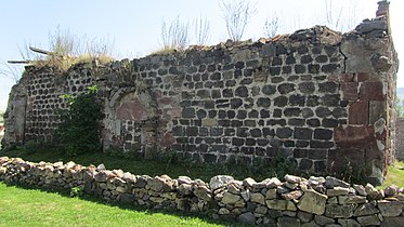 Hobardzi Church
.jpg)
References
External links

|
| This article about a location in Lori Province, Armenia is a stub. You can help Wikipedia by expanding it. |
Hobardzi
Հոբարձի | |
|---|---|
|
Panorama of Hobardzi from the main road into the village | |
Hobardzi | |
| Coordinates: 40°57′37″N 44°29′39″E / 40.96028°N 44.49417°E | |
| Country | |
| Province | Lori |
| Elevation | 1,345 m (4,413 ft) |
| Population | |
| • Total | 736 |
| Time zone | UTC+4 ( AMT) |
Hobardzi ( Armenian: Հոբարձի) is a village in the Lori Province of Armenia.
The village is located about 11 km south-east of Stepanavan and is close to the villages of Vardablur and Gyulagarak. The Stepanavan Dendropark is located about 3 km southwest of Hobardzi.
Gallery
-
Hobardzi Church
References
External links
|
| This article about a location in Lori Province, Armenia is a stub. You can help Wikipedia by expanding it. |